Originally Posted by
SASless
The statement that it was only 30 feet to go before he would have broken out is a bit lame....as there is no way to know how close he came to breaking out before losing control of the aircraft.
It does not change your analysis, but I suspect it was much more than 30 feet. From the ADS-B data supplied by the FAA, I estimate that the aircraft began the steep bank at 17:45:09Z at an altitude of approximately 2400' AMSL (2275' Geometric height from ADS-B + 117' WGS-84 to WGM-96 conversion), and reached a maximum height of approximately 2450' AMSL (2325' Geometric Height + 117' WGS-84 to WGM-96 conversion) at 17:45:15Z. This is higher than the reported cloud tops of 2400' AMSL, so that made me look at the cloud heights to see if the reports were accurate for the time of the crash. Watching the fire spotting videos, it is clear the tops are moving up and down, but I believe the cloud heights at the time of the crash were closer to 2700' than 2400'. This picture is from Saddle Peak, approximately 5 miles from the crash site, about 1/2 hour before the crash:
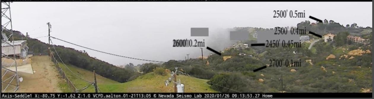 I used Google Earth (uses WGM-96) to estimate the AMSL height and distance of various features
Here is a picture at the time of the crash:
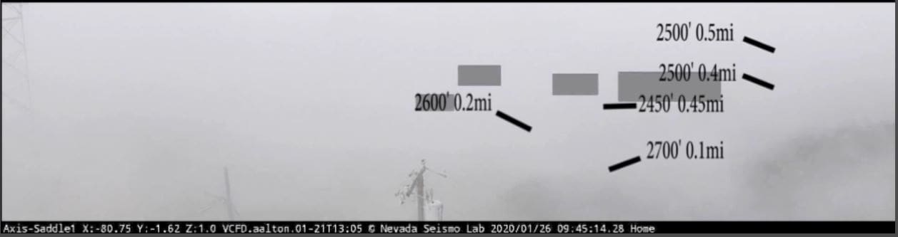 Notice that the feature at 2700' and 0.1 miles is barely visible, and even the closer tower and telephone poles are partially obscured.
Note: I estimate the accuracy of the ADS-B Geometric Height (WGS-84) at +/- 50 feet.
As an aside, Saddle Peak happens to be the location of the Santa Monica ADS-B antenna/receiver that collected most of the FAA data for the final minutes of the event.