Originally Posted by
treadigraph
Could be Google Maps doing the 3D stuff. OY-MIS also busy to the south of Stansted earlier on.
Hmmm. Mapping the Sea too?
I posted on this the other day and the post disappeared after a few minutes. I assumed moderated out?
D-FIPS
OY-MNS
G-ZDEA
G-DSPY
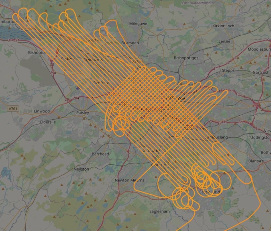
All working furiously the other day. Tracks are either NW<->SE or NE<->SW and on one observed occasion they did both in one area. Suggests to me some magnetic element to the task? Perhaps. There is often a right/left/right (or is it the other way?) turn or some imprecise orbits before the runs start.
D-FIPS
11-4-2021 - Survey - Troon to South Bute, land and sea.
Transit to Prestwick 1 April.
Flew survey trips :-
2nd, 3, 5, 6 (30 mins), 7 (90 mins), 9, 10, 11th, ...?
Also off Holland and Ireland.