Ockham85,
You won't be able to post URLs or images until you have ten posts. Here's the location you were referring to:
Here's the map URL:
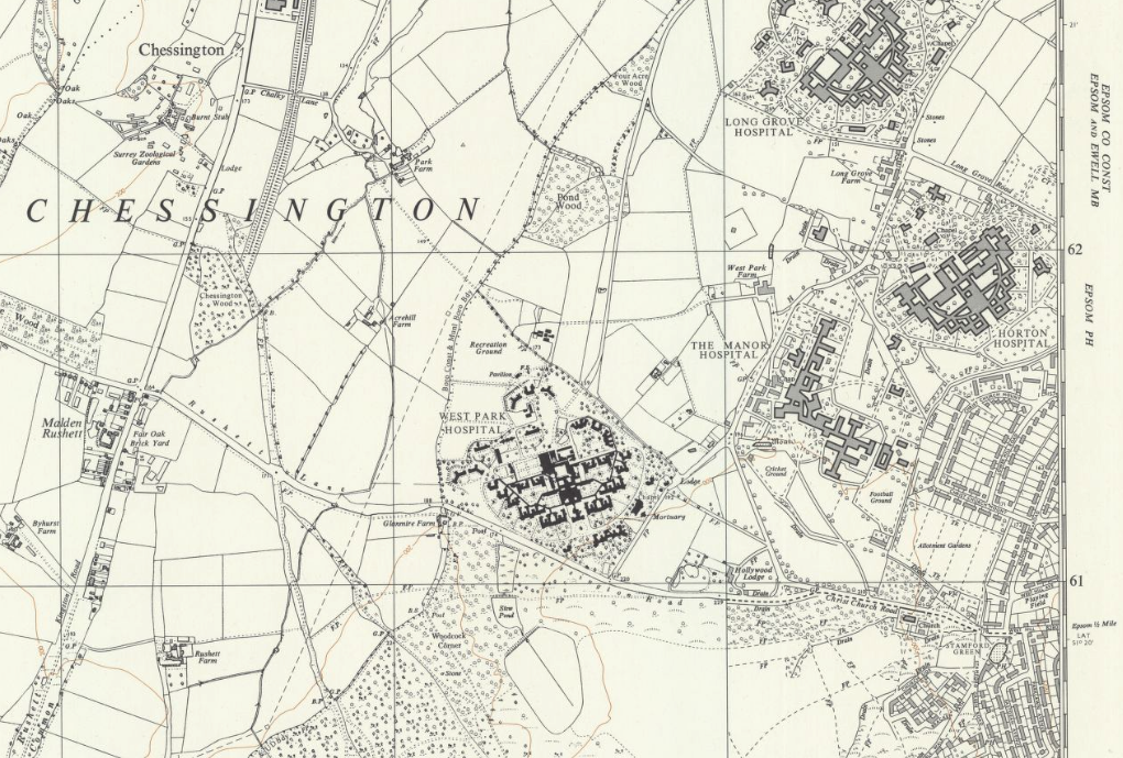
https://maps.nls.uk/view/189258746 (Sheet TQ 16 SE, Six Inches to the Mile, 1962). The NLS site is a truly wonderful resource if you like old maps.
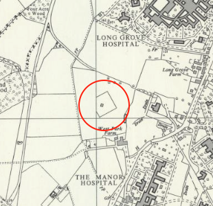
I estimated the 10m grid reference as TQ19036206 and converted it to WGS84 Lat/Long:
 http://www.movable-type.co.uk/script...s-gridref.html
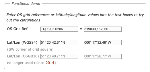
and then entered the Lat/Long into Google Earth:

If you zoom in, you can see the outline of the foundations!
PS I have just noticed that the conversion website gave me the OSGB36 Lat/Longs as well. If you assume they are WGS84 coordinates and plot them on Google Earth, you would have a point 59 m S and 110 m W of the true position.