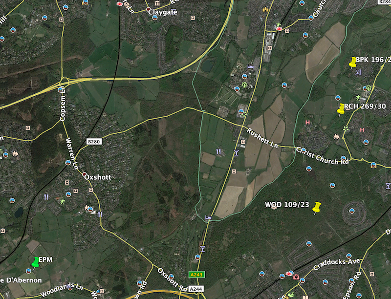
Some digging...
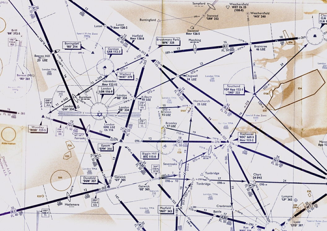
I've used this chart from 1960ish at
https://atchistory.wordpress.com/202...ow-atc-part-2/ and also taken the variation of 7w as given on the Jepp chart.
Plotting a three way fix from Brookmans park, Woodley and Rochester (and assuming none of those moved before 1991) gives a fairly wide spread but the general consensus seems to be somewhere about 3nm ENE of the current site.
Google earth clip below with the three plots in yellow and the current position in green.