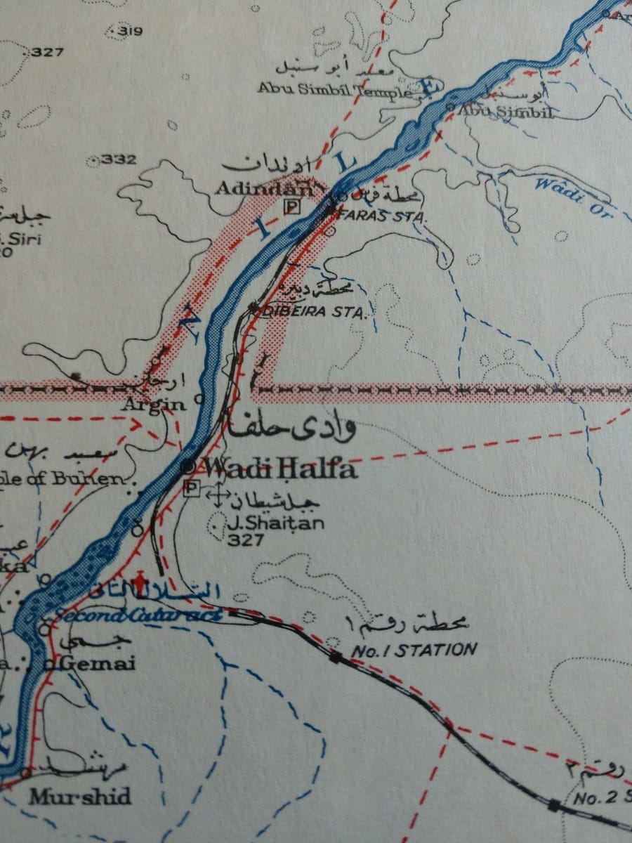
As requested above, a 1947 map showing previous location of Wadi Halfa town & airport (the red icon by the Nile to the southwest). Also my fairly unscientific guess (working off a bearing from Jebel Shaitan) at the submerged location of the old WH town - old airport would be few km south south west under Lake Nubia. The backdrop of the Britannia photo posted earlier seems to suggest that the old airport was indeed by the river, with an elevation shown as c500ft in Clandonman's fascinating video. This seems to fit with the tale of being submerged as the current shore height at the re-located Wadi Halfa new town is around 650ft. The new and far less appealing airport 15km east of WH is at over 950ft. (n.b. the map spot heights are in metres). Open to better guesses, of course!