Originally Posted by
377 Pete
Got my hands on the FULL ADS-B file which is 2 data frames per second as opposed to the one frame every five seconds that's been going around. Working on a .KML file for google earth. Looks to be a controlled left turn right over that address, until the last few data frames. Here's a link to an image host since I don't have 10 posts-
imgurDOTcom/a/KNsDRPu (replace 'DOT' with . )
Here's your image:
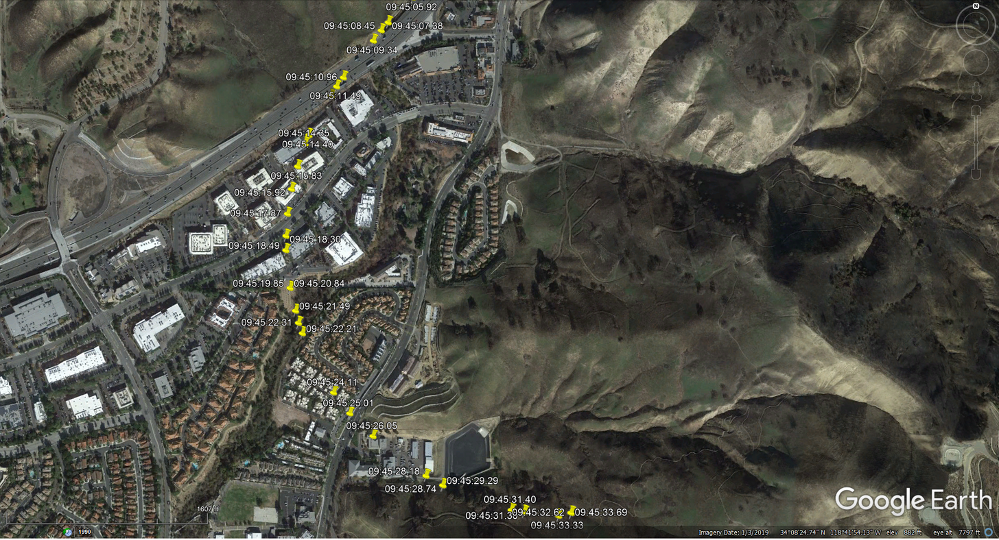 created by 377 Pete
This does look like the turn is too early for following the overpass by mistake.
I couldn't tell by the picture if this was a controlled turn or a graveyard spiral, but the very quick descent from 2300ft altitude is unlikely to be intentional.
Is the KML file at the bottom of the
FR24 blog page not based on the "granular" ADS-B data?