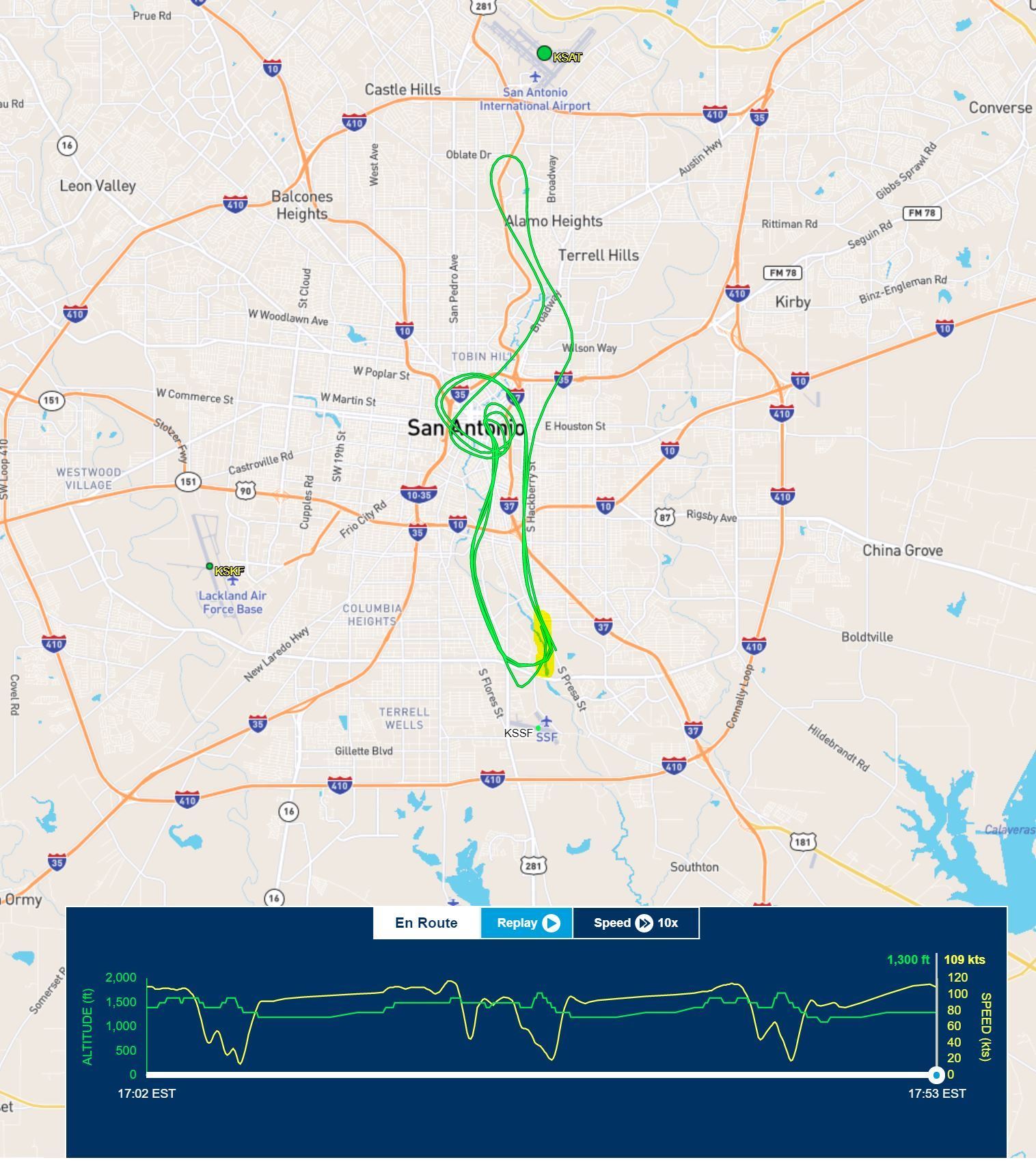
HeliHenri: thank you for that URL. I have highlighted in yellow the tail end of the track where it turns North just before the auto.
Bell Ringer and Crab: of course I understand the correlation between options and altitude. But until the data that HeliHenri pointed out was available to us, you, or at least Crab, was
assuming that low altitude was a significant factor in this incident. Such
assumptions were unfair until and unless they were proven. As it happens, it would appear that that assumption may be correct. Assuming (my assumption, this time) that FlightAware altitude data is MSL, it would certainly appear that this helicopter was quite low, given that KSSF field elevation is 577ft. This puts them only 700 or 800 AGL for much of the flight, and the last few minutes in particular. KSAT is at 809ft MSL.