Originally Posted by
Yaw String
At the high risk of stating what has already been stated here,..we brief MSA and MORA to avoid terra firma..
At what point during the departure do we ignore what we have briefed.Part of our responsibility is to pick up each other's mistakes made by our colleagues in the air,and on the ground,
Why would you not query a turn instruction that was going to severely infringe your terrain separation,as briefed!
Yet the tools available for such a departure briefing are poorly suited to the task... these instruments are far too blunt:
VTU7 chart:
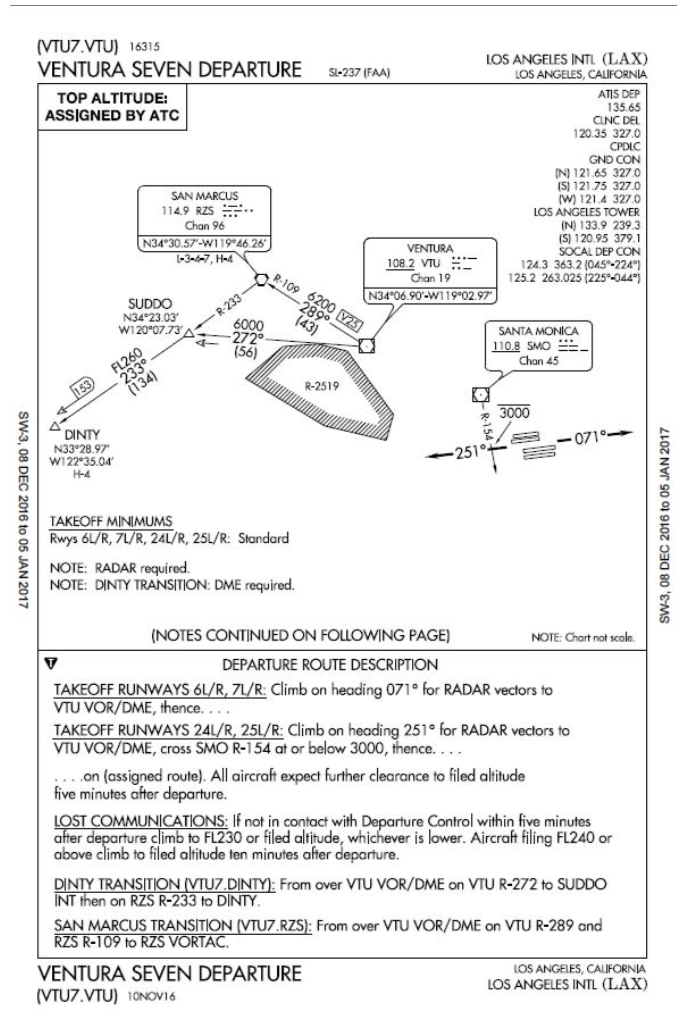 No MSA information whatsoever
ILS 7R approach chart:
 MSA information is entirely too coarse to be useable on any practical basis.
As mentioned above
MSA information is entirely too coarse to be useable on any practical basis.
As mentioned above, the tool best suited to the task would be a scalable MVA sector map in the cockpit.
Pilot groups and FSF have advocated... heck, they've begged... FAA to provide MVA sector information in a format suitable for cockpit display.
FAA ATO simply isn't interested... in fact, their uninterest goes beyond that... they've been worse than unresponsive... FAA ATO continues to stubbornly resist the concept entirely.