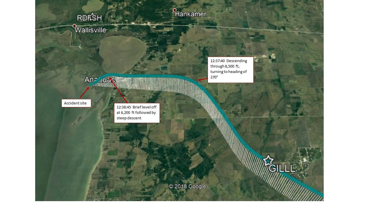
WASHINGTON (March 12, 2019) � The descent of Atlas Air flight 3591 and the communication between air traffic control and the aircraft pilots on Feb. 23, 2019, is depicted in this graphic. Atlas Air flight 3591, carrying cargo for Amazon and the U.S. Postal Service, crashed about 40 miles from Houston�s George Bush Intercontinental Airport. Three people died in the crash. (NTSB Graphic)
This is in agreement with DaveReidUK's ADS-B data analysis posted here the day after the mishap:
Originally Posted by
DaveReidUK
The FR24 data, as usual, contains numerous artifacts and synchronisation issues.
That said, once cleaned up it appears to show a slight but unmistakeable climb interrupting the descent just before reaching 6000', starting about 10 seconds before the beginning of the final dive.
It's exaggerated, obviously, in this foreshortened view (apologies for the skewed verticals):