Back on the topic of the SWA over-run itself.
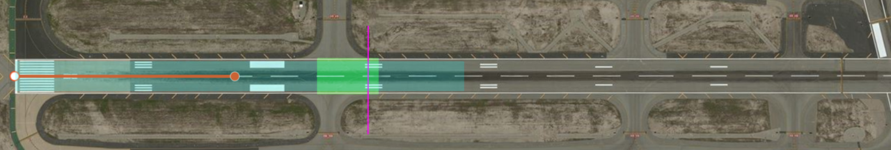
Red point
= nominal 3� slope intersect with pavement (assuming 50' at THR)
Green field
= expected landing area as per FCOM and AFM/performance assumptions
Blue area
= conventional understanding of touchdown zone (1/3rd of the runway here)
Magenta line
= actual position of the PAPI
Note: according to ICAO Annex 14 there should only be 4 distance markers for this runway length.
The crew should fight nails and teeth to use this in their defence. The PAPI will take you 600 feet beyond the proper aiming point, and the last two distance markers on the pavement are nothing but a deathtrap.
Comments?