I'm failing to see what the issue is. The platform altitude is 6000ft so they need to be at that and pretty stable by the time they descend (at 15NM), so if they need to lose height then they can do this to the south of the LOC quite safely.
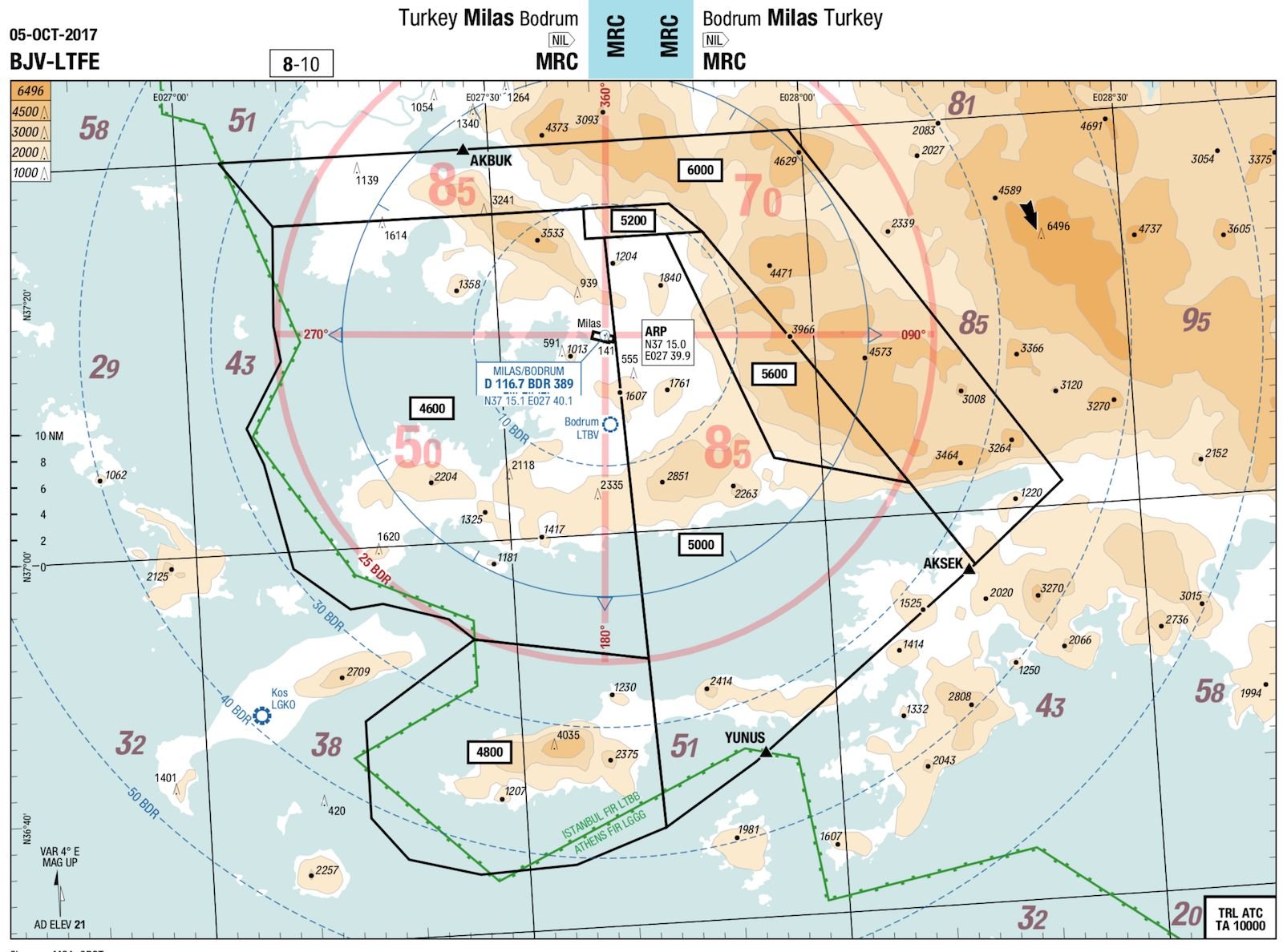
If they do it in the 15NM localiser position (north, south, east OR west) at a sensible speed, they will stay above the Radar Minimum Altitude within 25NM of the BDR, which is easily achieved. The lowest Radar Minimum is 6000ft so can lose any height required down to this level safely. I don't really understand why the MSA is so high as I can't find any terrain within 25NM of the field above 4600ft, there is a hill going up to 6500ft outside 30NM, but this really can't affect them. Here is the LIDO Minimum Radar Chart which has kept the belly of the aircraft soil free for some time now.
MSA is Minimum Sector Altitude, each sector on this chart covers 500 square miles, which isn't much use apart from the day that you've completely lost the plot and need to climb to a safe altitude to out where you went wrong.
How do you guys accept descent clearances to the ILS whilst radar vectoring clearances in IMC? Just hope and prayer?