


Latitude limitations for the use of IRS

Thread Starter
Join Date: Jan 2010
Location: India
Posts: 139
Likes: 0
Received 0 Likes
on
0 Posts
Hello, during one of my interviews I was asked about the N and S latitude limitations for the use of IRS. Does any one know the exact latitude N and S values? Apparently they aren't the same latitudes and South latitude is lesser than the north. What is the reason for this? What is the reason for the limitation in the first place? I cant seem to find the answer in any of the books I have.

Join Date: Nov 2015
Location: BRS/GVA
Posts: 342
Likes: 0
Received 0 Likes
on
0 Posts
I cant answer the question directly, but knowing how IRS works, i cant see why there would be any latitude limits. A gyro based IRS would track movements in 3 axes wherever it is on the planet surely?
Join Date: Apr 2010
Location: IRS NAV ONLY
Posts: 1,230
Likes: 0
Received 0 Likes
on
0 Posts
The exact latitude limitations will depend on the aircraft type. Most manufacturers offer "polar" option, which removes the latitude limitations and I believe the limitation is more related to the FMC and autoflight rather than the IRS, as the FMC has to transit into the "polar" mode and use true headings/tracks/courses for navigation rather than magnetic ones. Same goes for the autoflight system.
This Boeing article on navigation in polar regions might be useful.
This Boeing article on navigation in polar regions might be useful.
Last edited by FlyingStone; 6th May 2019 at 10:27. Reason: Added link

Thread Starter
Join Date: Jan 2010
Location: India
Posts: 139
Likes: 0
Received 0 Likes
on
0 Posts
I remember there being a limit for INS. Approximately 70 degrees N/S because the INS cant figure out E/W from N/S due to high latitudes. Any idea about that. Cant seem to find the reference anywhere though.
Thread Starter
Join Date: Jan 2010
Location: India
Posts: 139
Likes: 0
Received 0 Likes
on
0 Posts
The exact latitude limitations will depend on the aircraft type. Most manufacturers offer "polar" option, which removes the latitude limitations and I believe the limitation is more related to the FMC and autoflight rather than the IRS, as the FMC has to transit into the "polar" mode and use true headings/tracks/courses for navigation rather than magnetic ones. Same goes for the autoflight system.
This Boeing article on navigation in polar regions might be useful.
This Boeing article on navigation in polar regions might be useful.
Only half a speed-brake
DJF, not really. The machine does calculate with TRUE track inside, however, the information supplied out to the various other aeroplane systems is converted to MAGNETIC heading for compatibility. There is a magnetic variation table (hopefully well updated) inside the IRS boxes.
What FlyingStone means is that some aeroplanes have a switch to change all navigational instruments / computers into TRUE track, which enables polar area navigation. The IRS do not care as long as they had been built to operate at high latitudes.
At least on the CEO Airbus generation.
What FlyingStone means is that some aeroplanes have a switch to change all navigational instruments / computers into TRUE track, which enables polar area navigation. The IRS do not care as long as they had been built to operate at high latitudes.
At least on the CEO Airbus generation.
Thread Starter
Join Date: Jan 2010
Location: India
Posts: 139
Likes: 0
Received 0 Likes
on
0 Posts
So basically there are no limitation then apart from the switching to true navigation in polar regions? As in no machine (accelerometer) restrictions?
Thanks, that is what I thought too but apparently there is a limit, at least according to the person interviewing me.
I remember there being a limit for INS. Approximately 70 degrees N/S because the INS cant figure out E/W from N/S due to high latitudes. Any idea about that. Cant seem to find the reference anywhere though.
I remember there being a limit for INS. Approximately 70 degrees N/S because the INS cant figure out E/W from N/S due to high latitudes. Any idea about that. Cant seem to find the reference anywhere though.
Join Date: Apr 2010
Location: IRS NAV ONLY
Posts: 1,230
Likes: 0
Received 0 Likes
on
0 Posts
It could also be the case that certain aircraft are fully able of polar flight from the factory, but require an AFM supplement or modification enabling operation over the poles, which obviously costs a lot of money.
DJ Flyboy Don�t confuse the two limitations.
1. Alignment. Most IRSs can�t align above the low 80s N/S as there is not enough change in velocity to align the gyro. Think a gyro at the pole is just rotating like a record player. These limitations are invariant of hemisphere.
2. Operational areas that give accurate mag track for the ADIRUs. This is dependant on the magnetic variation tables which are no symmetrical in each hemisphere.
Thread Starter
Join Date: Jan 2010
Location: India
Posts: 139
Likes: 0
Received 0 Likes
on
0 Posts
Thanks everyone for the answers. Much appreciated
Join Date: Nov 2015
Location: BRS/GVA
Posts: 342
Likes: 0
Received 0 Likes
on
0 Posts
DJ Flyboy Don�t confuse the two limitations.
1. Alignment. Most IRSs can�t align above the low 80s N/S as there is not enough change in velocity to align the gyro. Think a gyro at the pole is just rotating like a record player. These limitations are invariant of hemisphere.
1. Alignment. Most IRSs can�t align above the low 80s N/S as there is not enough change in velocity to align the gyro. Think a gyro at the pole is just rotating like a record player. These limitations are invariant of hemisphere.
Well, the Boeing answer is in the FCOM:
ADIRU
ADIRU alignment must not be attempted at latitudes greater than 78 degrees, 14.75 minutes.
This is the latitude of Svalbard/Longyear ENSB.
ADIRU
ADIRU alignment must not be attempted at latitudes greater than 78 degrees, 14.75 minutes.
This is the latitude of Svalbard/Longyear ENSB.
I'm hazarding a guess at Gyrocompassing being possibly more problematic at high latitudes but that's possibly ancient history and since a long time since I heard a specialist navigator moaning about the dark arts of Inertial alignments so I'll stand by to be corrected and getting the full story.
Last edited by wiggy; 6th May 2019 at 15:09.
Join Date: Jun 2014
Location: Mordor
Posts: 338
Likes: 0
Received 0 Likes
on
0 Posts
IIRC A320 has limitations both for alignment and operation at higher latitudes - don�t have the FCOM at hand to give specific numbers. Anyhow, not possible to operate in Polar regions and use True REF
OTOH A330 has only alignment limitations and has to be used in true ref above certain LAT.
OTOH A330 has only alignment limitations and has to be used in true ref above certain LAT.
Join Date: Sep 1998
Location: wherever
Age: 55
Posts: 1,616
Likes: 0
Received 0 Likes
on
0 Posts
Every AFM Iv'e read has alignment limits for IRS. Often pan handled around the North Pole.
Some also include operational regions for older units.
Would love to hear Hoss183's secret info about how a gyro (laser or otherwise) works. I've only read Honeywells description.
Some also include operational regions for older units.
Would love to hear Hoss183's secret info about how a gyro (laser or otherwise) works. I've only read Honeywells description.
Join Date: Feb 2019
Location: shiny side up
Posts: 431
Likes: 0
Received 0 Likes
on
0 Posts
A320F has a latitude limit for alignment of 82 N/S with or without the polar nav mod. And between 60 and 82 it takes significantly extra time.
One of the advantages of the polar nav mod is that it is selected before the boundary of the Mag database area to avoid tripping the AP and ATHR off as the ADIRUs swap from Mag to True automatically as usually they don’t swap in exact sync. Additionally there is a Grid reference on the screen above 65�.
From the Generic A330 FCOM:
The ADIRU gives true heading instead of Magnetic Heading
Above 82�N
Above 73�N between 90�W and 120�W
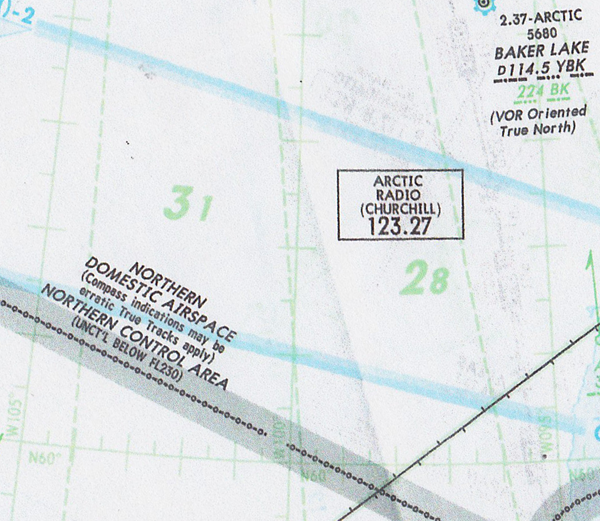
Above 60�S (make sure you understand that above in the Southern Hemisphere is higher latitudes, ie below on the map!)
The limitation on the A320 and the A330 are the same if the Polar Nav mod is fitted. Obviously most narrow bodies don't go into the polar region so it's not fitted as standard. A while ago I was told that there was only one narrow body Airbus in existence with the Polar Nav Mod, although with the growth of the LR and CJ narrow body fleet, I imagine that would no longer be true. The operational limits are the same as I quoted above.
Semantics are an issue here- don't mix up the geographic term Polar Regions with the polar regions area as determined by Honeywell et al. If the system is capable to navigate in True up to 82N, then the same is true for up to 82S, but for the IRS manufacturers the Polar Region definition starts at 60S due to magnetic database absence so (legalities aside) you could practically operate in True in the polar region at say 65S. The same logic for that 90W-120W sector.
One of the advantages of the polar nav mod is that it is selected before the boundary of the Mag database area to avoid tripping the AP and ATHR off as the ADIRUs swap from Mag to True automatically as usually they don’t swap in exact sync. Additionally there is a Grid reference on the screen above 65�.
The ADIRU gives true heading instead of Magnetic Heading
Above 82�N
Above 73�N between 90�W and 120�W
Above 60�S (make sure you understand that above in the Southern Hemisphere is higher latitudes, ie below on the map!)
IIRC A320 has limitations both for alignment and operation at higher latitudes - don’t have the FCOM at hand to give specific numbers. Anyhow, not possible to operate in Polar regions and use True REF
OTOH A330 has only alignment limitations and has to be used in true ref above certain LAT.
OTOH A330 has only alignment limitations and has to be used in true ref above certain LAT.
Semantics are an issue here- don't mix up the geographic term Polar Regions with the polar regions area as determined by Honeywell et al. If the system is capable to navigate in True up to 82N, then the same is true for up to 82S, but for the IRS manufacturers the Polar Region definition starts at 60S due to magnetic database absence so (legalities aside) you could practically operate in True in the polar region at say 65S. The same logic for that 90W-120W sector.
Last edited by compressor stall; 7th May 2019 at 00:34.