


Kobe Bryant killed in S76 crash


Join Date: Jul 2005
Location: SoCal
Posts: 1,929
Likes: 0
Received 0 Likes
on
0 Posts
I live in L.A. and fly (small fixed wing) in that area. For those unfamiliar: radio workload was normal for the area, the numbers used are freeways which everyone who flies here is familiar with and ATC cannot hear you and/or provide radar service in that area below about 2000 / 2500 ft. The 'too low' comment refers to that.

If this is any more than yet another IIMC at low level, an atttempted turnback/180 and resultant CFIT, I will be very surprised.
There has been mention that if they'd gone IFR, they would have had to land at an airport. In the US at least (maybe not in Europe, no idea) it's perfectly legal to fly an approach to an airport then once you're in VMC, break it off and fly under the clouds to wherever you're going. Standard practice even FW if you're going to an airport that doesn't have an approach and the ceiling is reasonable.
Join Date: Jul 2005
Location: SoCal
Posts: 1,929
Likes: 0
Received 0 Likes
on
0 Posts
The wx being what it was, the option would have been to fly to KCMA and take a car from there. KCMA sits on a coastal plain, the academy is much higher up and would have been in the crud.
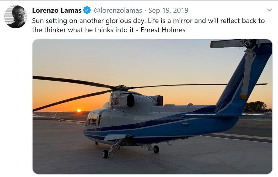
The 76C and D have seating configurations for up to 8 individual crash-worthy seats plus the four-person bench on top of the fuel cell. These are not plush cushioned leather armchairs, but the latest seats would pass in a VIP/airliner interior. Removing one seat nearest the door allows for much easier loading/unloading without having to tilt any seats. I doubt improper seating was allowed here.
Join Date: Jun 2001
Location: Rockytop, Tennessee, USA
Posts: 5,898
Likes: 0
Received 1 Like
on
1 Post
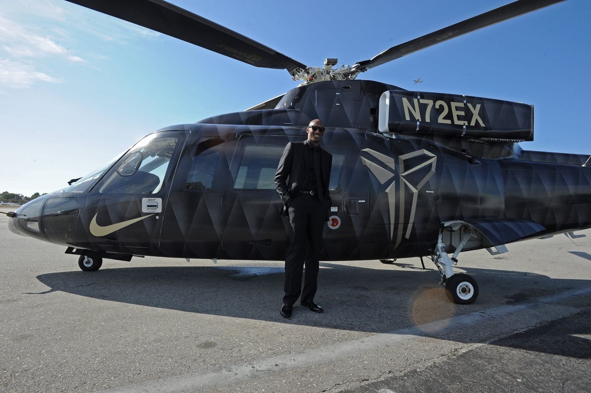
just a question regarding the flashy black helicopter, and I am sorry I didn't browse through 6 pages to see if anyone else made note.
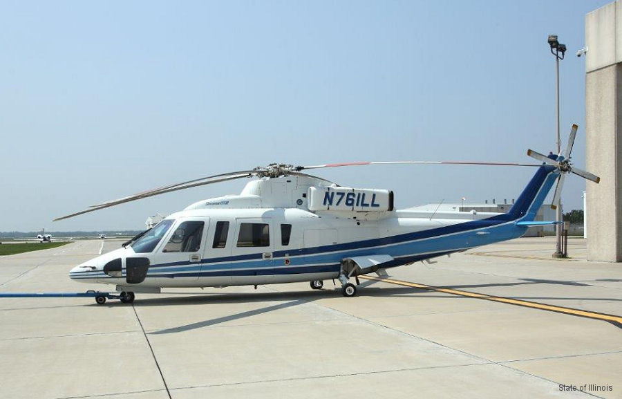
what paint scheme was this in? we have all seen the black one adorned with nike etc, and the blue and white we all assumed was the original scheme. it definatly looked like a dated corporate scheme.
I see blue and white in the crash scene video. Was the black a temporary wrap for a promotion??
what paint scheme was this in? we have all seen the black one adorned with nike etc, and the blue and white we all assumed was the original scheme. it definatly looked like a dated corporate scheme.
I see blue and white in the crash scene video. Was the black a temporary wrap for a promotion??
It appears that the S-76 was in the same livery when it was sold at auction in 2015 by the state of Illinois as N761LL.
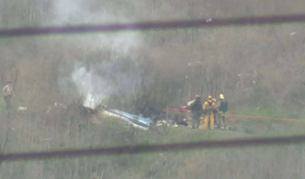
From the crash site:
It does look like the helo was in the black Nike paint scheme for a while.

Last edited by Airbubba; 27th Jan 2020 at 16:48.
Are we certain Mamba Academy was the destination?
KCMA sits on a coastal plain, the academy is much higher up
As for taking a car from KCMA - it's only 3 miles or so but if they were already hitting a deadline... we all know that "just taking a car" easily adds half an hour to the journey time.

Join Date: Dec 2016
Location: Europe
Posts: 4
Likes: 0
Received 0 Likes
on
0 Posts
..could it be that the pilot had decided the wx was too bad, he knew where he were, that The Sheriff's Agoura Rd. HeliPad was close, and due to the bad visibility he turned a few seconds too early, thinking he just had to cross Agoura Rd. and then he would be at the HeliPad - then realising that he turned the wrong place, and due to limited visuals he was ending up in a non-normal which he couldn't get out of..? It only takes a few seconds to lose control due to vertigo and such, close to ground.
Join Date: Aug 2002
Location: Zone of Alienation
Age: 79
Posts: 9
Likes: 0
Received 0 Likes
on
0 Posts
Any helo drivers care to advise why it would be- barring major airport airspace complications- not common practice to file an IFR flight plan and cruise at say, 5000� or so, well clear of terrain? Then cancel the IFR and land visually at the destination? I never understood running scuds if it weren�t entirely, positively necessary.
Join Date: Jul 2005
Location: SoCal
Posts: 1,929
Likes: 0
Received 0 Likes
on
0 Posts
It's slightly to the right of 101, which makes a perfect visual ILS (if you see what I mean).
It's at 692 feet (according to caltopo), so IF the ceilings being given were correct, it would have worked. But your suggestion of hitting a fog bank seems highly probable, so the ceiling info would be wrong in that case.
As for taking a car from KCMA - it's only 3 miles or so but if they were already hitting a deadline... we all know that "just taking a car" easily adds half an hour to the journey time.
Surely it�s the norm when there�s any question weather wise to have a backup plan like a car? The pilot being hailed elsewhere as exceptional and experienced, but exceptional IFR decision maker etc? How long and how many hours single pilot S76 in actual IFR has he I wonder. As above it�s Monday morning quarterbacking. Nothing personal and don�t know the individual.
Any helo drivers care to advise why it would be- barring major airport airspace complications- not common practice to file an IFR flight plan and cruise at say, 5000� or so, well clear of terrain? Then cancel the IFR and land visually at the destination? I never understood running scuds if it weren�t entirely, positively necessary.
Join Date: Jun 2001
Location: Rockytop, Tennessee, USA
Posts: 5,898
Likes: 0
Received 1 Like
on
1 Post
Would this be a part 135 operation? Or is there some part 91 'cost sharing' scheme that may have been used to skirt the regs? This seems to be a recurring theme in these small aircraft charter crashes.
I think the accident statistics would tend to support that claim.
I think the accident statistics would tend to support that claim.
Join Date: Aug 2012
Location: Northeast Area, USA
Posts: 12
Likes: 0
Received 0 Likes
on
0 Posts
I don�t know what avionics this aircraft was equipped with, but even ForeFlight for $200 per year would provide moving terrain maps, which probably would have helped more than distractions of numerous radio frequencies, while getting caught �special VFR� in the soup, near terrain. Tragic.
Any helo drivers care to advise why it would be- barring major airport airspace complications- not common practice to file an IFR flight plan and cruise at say, 5000� or so, well clear of terrain? Then cancel the IFR and land visually at the destination? I never understood running scuds if it weren�t entirely, positively necessary.
Not commenting on the cause of the accident, just the above query:
Significantly difficult if you're above cloud and your min descent altitude is above the cloud base - often the case in hilly/mountainous areas where the tops are in clouds but the valleys are clear. In that case decent chance you wouldn't be able to descend without an instrument approach, which is often far enough away that you'll end up " scud-running " underneath anyway.
To be honest, flying underneath is perfectly safe so long as you're aware of the limits (of yourself and your machine). The killer historically (and I am specifically not talking about this accident) has been press-on-itus, due to whatever pressure. This gives often gives an accident sequence either inadvertantly entering IMC, or a last ditch mvr/CFIT trying to avoid it, when often the slow down/turn around option much earlier would have been perfectly safe.
I'd agree, it's a different mindset to airline flying. However, most corporate rotary flying is much closer to BizJet flying, which holds a very different set of pressures to airlines. You see similar "press on" accidents in that world. No way you can compare directly to airlines.
Join Date: Jul 2008
Location: In the Alps
Posts: 185
Likes: 0
Received 0 Likes
on
0 Posts
And yet, in 35 years I�ve never had anyone question my landing except the police ( who in these days of cell phones always seem to get called ) and nothing has ever happened as a result of talking to the police. I tell them I landed because of the weather, they ask a couple ( sometimes silly ) questions. They drive away and I never hear anything else about it.
Join Date: Sep 2011
Location: Los Angeles
Posts: 370
Likes: 0
Received 0 Likes
on
0 Posts
I'm a fixed wing pilot. First some data, then some questions for the helo pilots here...
METARs and PIREPs around the time of the crash show the marine layer bases were around 1500' and tops around 2500', with marginal visibility:
According to the USGS Topo maps I have of the area, the highway elevation along the 101 tops out around 1100' just to the east of Las Virgines Rd, with hills up to 2000' to the north and south. Approaching Las Virgines, the highway dips into a valley and is at about 760' elevation. Two private helipads in the area are charted at 850' and 888'. Further west, the highway rises back to around 900' before descending through the Conejo Grade towards Camarillo.
Tracks posted upthread show N72EX was following US-101, at an altitude around 1200'. This suggests they were flying in hazy conditions just below the cloud deck. While the conditions were certainly marginal, they appear to have done just fine following the 101, and had already passed the highest portion of the highway along their route. (The south/east-bound turn started west of Las Virgines)
Assuming the FR24 and FA data are to be believed, N72EX then turned to the south/east, and possibly started a climb before the crash. My questions:
1) Are inadvertent IMC procedures the same for helos as fixed wing - that is, doing a 180? I'd imagine there are more options including trying to slow, hover, or try to set down short of a cloud bank if one sees it looming, or is that not practical?
2) What is the maximum climb capability of the S-76? (i.e. how long to get on top of a 1000' foot cloud layer, if required)
Putting it differently:
3) Are there any circumstances where a helo pilot would choose to turn and climb like that, knowing it would put them into a cloud especially if they weren't already?
Ladyface Mountain in Agoura (3 miles W of the crash site) is right alongside the South side of the 101 and rises to 2031 feet.
The 101 in that 13 mile stretch is not the place for scud running.
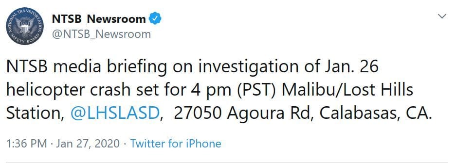
The 2 helipads - one is at the LACFD Fire Station on Las Virgenes Rd and the other is LACSD Lost Hill Station.
On that morning all Police and Sheriff's Department helicopters were grounded due to viz...