


Blackhawk down Taiwan

Thread Starter
Blackhawk down Taiwan
Top military brass on board.
https://www.taiwannews.com.tw/en/news/3848738
https://japantoday.com/category/worl...rgency-landing
https://www.taiwannews.com.tw/en/news/3848738
https://japantoday.com/category/worl...rgency-landing

Thread Starter
Sad follow-up.
https://www.aljazeera.com/news/2020/...024130620.html
https://www.aljazeera.com/news/2020/...024130620.html
watched a documentary about the blackhawk lately - and that its crash survivability was the reason it won against its rival.
Its a rumor network - and even while they say, weather wasn’t a factor, my rough guess is, that it was CFIT...
To much high ranking personal on board for a normal taiwanese pilot to insist on No... (my guess)
Its a rumor network - and even while they say, weather wasn’t a factor, my rough guess is, that it was CFIT...
To much high ranking personal on board for a normal taiwanese pilot to insist on No... (my guess)
Last edited by Flying Bull; 2nd Jan 2020 at 16:28.
Join Date: Jan 2016
Location: Uk
Posts: 213
Likes: 0
Received 0 Likes
on
0 Posts
https://www.scmp.com/news/china/mili...forced-landing
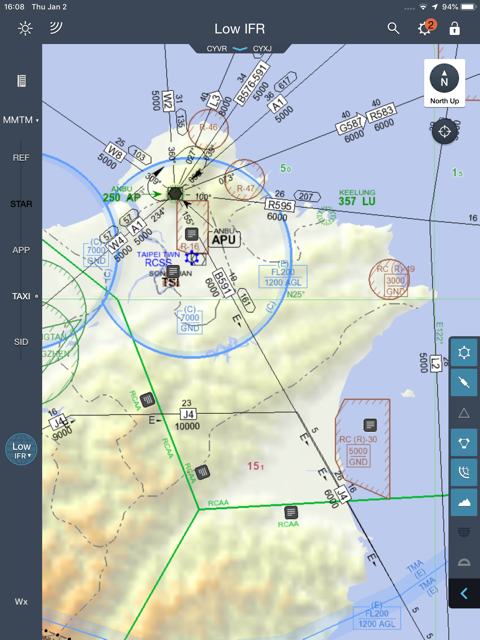
Really no structure for IFR, no approaches at destination. Now you or I may have just done a cloud break past the shoreline offshore, but I doubt their ATC system would swallow such a concept. National Military pilots in SE Asia seem unlucky with CFIT, might be for cultural reasons as someone has already hinted.
Here’s some “pichers”. How would you have done it?
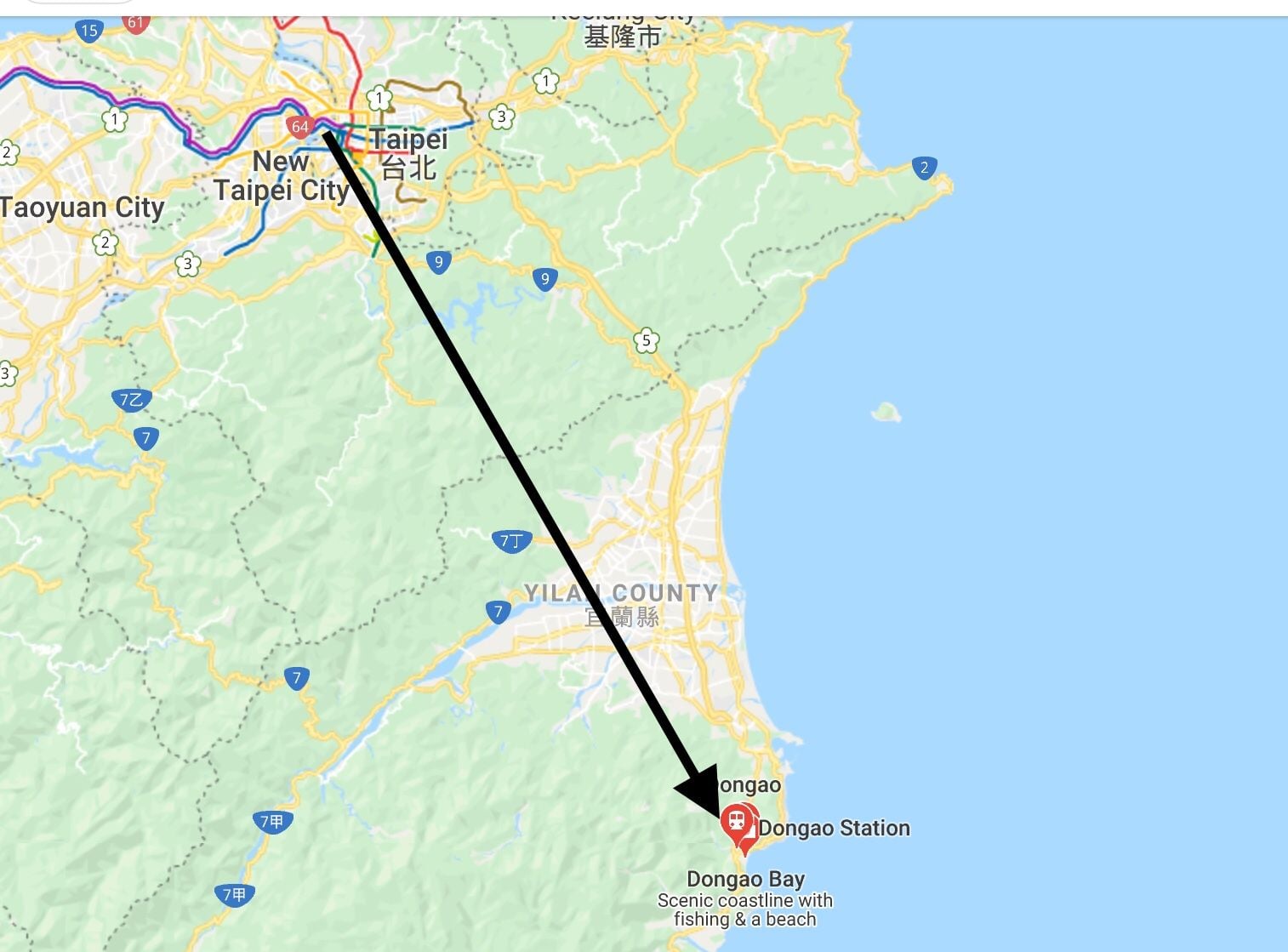
Here’s some “pichers”. How would you have done it?
Too many Generals aboard the one aircraft. Took a big chunk out of the top brass in one fowl swoop. By the look of the crumpled remains of that 60M it was lucky anybody survived. But then again, it is a BlackHawk. Doubt very much it met its demise through any mechanical fault, particularly in view of the terrain and weather.
Join Date: Jul 2007
Location: the City by the Bay
Posts: 547
Likes: 0
Received 0 Likes
on
0 Posts
There are some nice trains they could have taken or they could even have driven. Nice roads to where they were going.
Bad weather and mountains and helicopters often don�t do well together. And in Taiwan bad weather and mountains are almost daily.
Bad weather and mountains and helicopters often don�t do well together. And in Taiwan bad weather and mountains are almost daily.
well, haven�t been there and don�t know the excact conditions on the day - but looking at satellite pictures, initially going east north east until reaching the coast and following it to the south might have been a safer option.
With real low cloud going north directly to the shoreline would have added another 30 min isch to the flight time - but would still be a safer way to accomplish the mission ....
With real low cloud going north directly to the shoreline would have added another 30 min isch to the flight time - but would still be a safer way to accomplish the mission ....
Stay above MSA until at Dongao then a GPS letdown over the sea - then coast in slowly at about 100' asl/agl - or just stay at home.
Originally Posted by [email protected]
Stay above MSA until at Dongao then a GPS letdown over the sea - then coast in slowly at about 100' asl/agl - or just stay at home.
Originally Posted by [email protected]
Stay above MSA until at Dongao then a GPS letdown over the sea - then coast in slowly at about 100' asl/agl - or just stay at home.
Thread Starter
All Taiwan Blackhawks grounded.
https://time.com/5758215/taiwan-grou...copters-crash/
https://time.com/5758215/taiwan-grou...copters-crash/
FB and SLB - I don't know what the fit of their aircraft is - do they have radar and or floats?
I wasn't suggesting it as an SOP, just as a way of getting down if you were stuck.
I wasn't suggesting it as an SOP, just as a way of getting down if you were stuck.
Crab is right on this one.
Very similar emergency technique was common down in the Oil Patch in Louisiana and other offshore operations......if you got caught out by the fog or banks.
The letdown was over the sea or over the swamp.....using radar, rad alt, and reduced airspeed....and if so equipped...use the auto-pilot.
In VFR only aircraft with just the basic panel....same technique in an emergency situation.
Ironic that the Time article says the aircraft was one specifically purchased and specc'd for SAR.
Join Date: Jul 2007
Location: the City by the Bay
Posts: 547
Likes: 0
Received 0 Likes
on
0 Posts
Very similar emergency technique was common down in the Oil Patch in Louisiana and other offshore operations......if you got caught out by the fog or banks.
The letdown was over the sea or over the swamp.....using radar, rad alt, and reduced airspeed....and if so equipped...use the auto-pilot.
In VFR only aircraft with just the basic panel....same technique in an emergency situation
The letdown was over the sea or over the swamp.....using radar, rad alt, and reduced airspeed....and if so equipped...use the auto-pilot.
In VFR only aircraft with just the basic panel....same technique in an emergency situation
