


How to decode some info in METAR


Thread Starter
Join Date: Oct 2021
Location: Taiwan
Posts: 2
Likes: 0
Received 0 Likes
on
0 Posts
Hi All,
I am learning to read METAR but some questions come into my mind and need some help. Thanks a lot in advance.
For example:
METAR 100300Z 06006KT 010V090 1200
R04/1400U +SHRA SCT002 BKN005 SCT010TCU
OVC020 24/24 Q1012 TEMPO 3000 SHRA RMK
TCU OVHD A2991 RA AMT 8.8MM(B)=
I know how to decode some of the above but below are what I am not sure about:
what are the range of wind direction and wind speed?
what is the weather phenomenon information?
what is the ceiling of the cloud coverage?
how can I appropriately decode the information after RMK?

Join Date: Jun 2004
Location: Just Around The Corner
Posts: 1,395
Likes: 0
Received 0 Likes
on
0 Posts
Hi,
Metar day 10 0300 utc , wind 060 10 kts , direction varaible from 010 and 090 deg. visibility 1200 mt
rvr rwy 04 , 1400 mt Unchanged , eavy SHowers RAin , SCaTtered200 ft ,BroKeN 500 ft scattered 1000ft , towering cumulous
overcast 2000ft temp 24 dew point 24 , QNH 1012, Tempo vis. 3000mt , showers rain , remark
Towering CUmulous OVerHeaD , pressure in hinches of mercury 2991, RAin , AMendmenT 8,8 mm of rain (B)eginning , end of report (=).
It would be easier (and safer?) if they moved on from the world of the telex and published the forecasts in a more easily understandable format. I'm sure modern communications technology is up to the task now.

Join Date: Mar 2001
Location: I wouldn't know.
Posts: 4,499
Likes: 0
Received 0 Likes
on
0 Posts
I have to disagree. Coded METARs and TAFs are actually a very nice thing, allows for quick scanning of several or even many airports along a route. Of course, it requires a bit of a routine in doing so, but everyone doing it for a living should be able to do that. And for those that don't want to, there are more than enough decoder apps like Aeroweather and similar ones.
I'm sure modern communications technology is up to the task now.
I agree with Denti, it takes a lot longer to read plain text weather reports than to scan through the coded METARs and TAFs, And as said, plenty of apps that will de-code, if desired.
It always makes me laugh, on many hobby-flyer forums, to hear this complaint about how 'hard" it is to decode weather, when just a post or two previous, the same person has no trouble whatsoever conversing about engines, or avionics, "I've got a V35B with a TAT TN IO550, my panel has a G5340W with 2 G5s, a G330ES, and Century III AP......."
It always makes me laugh, on many hobby-flyer forums, to hear this complaint about how 'hard" it is to decode weather, when just a post or two previous, the same person has no trouble whatsoever conversing about engines, or avionics, "I've got a V35B with a TAT TN IO550, my panel has a G5340W with 2 G5s, a G330ES, and Century III AP......."
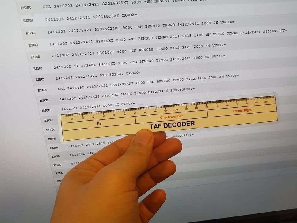
A skipper I flew with years ago had the bright idea of a "geostrophic scale" you could place alongside a TAF to get a full forecast. The longer the TAF the worse you knew the weather was going to be, and thus saving you reading the whole thing.
Last edited by Dunhovrin; 5th Oct 2021 at 07:50.
True. And it's in the private pilot exams, too. Though as this is a private pilots' forum, maybe you could be a bit tolerant and allow a lesser skill level. The OP did come here to learn, after all. I don't think any pilot was born with all the knowledge and skills required.
A skipper I flew with years ago had the bright idea of a "geostrophic scale" you could place alongside a TAF to get a full forecast. The longer the TAF the worse the weather was going to be,

One of the problems of standard METARS is that they are not standard world wide particularly in the RMK section, where local variations can be unknown to the international pilot. For example I found even my instructor had difficulty with this the other day.
RMK AO1 1037 SLP202 T01330122 50133
Most of it is known to pilots but what is the 1037, is the sea level pressure in inches or hectopascals and what is the 50133 group? I cannot decode it from a google search.
Thanks
RMK AO1 1037 SLP202 T01330122 50133
Most of it is known to pilots but what is the 1037, is the sea level pressure in inches or hectopascals and what is the 50133 group? I cannot decode it from a google search.
Thanks
As has been pointed out, this is private flyers forum, so maybe it helps keep us all safe if the vital information we all need to go flying is as clear and transparent as possible. The suggestion that their are multiple apps that will decode it for you sort of support that.
But the point behind my original comment was that if information has to be coded and then decoded you are surely introducing scope for mistakes and misinterpretation. Since the reason to code the data has now disappeared, why are still doing it. Just do it in plain?
Suppose I'll just have to get myself one of IFT's TAF decoders...
Join Date: Jun 2004
Location: Just Around The Corner
Posts: 1,395
Likes: 0
Received 0 Likes
on
0 Posts
RMK A01 type of automated station / 1037 time ? / SLP in hetcopascal 1020,2 / T hourly temp.and dew point 13,3/12,2 (T1 if negative)
50133 change of pressure on the past three hours ( decreasing of 13,3 mb)
https://www.weather.gov/media/wrh/me...decode_key.pdf
https://www.skybrary.aero/bookshelf/books/1543.pdf
https://www.e-education.psu.edu/file...oding1203.html
50133 change of pressure on the past three hours ( decreasing of 13,3 mb)
https://www.weather.gov/media/wrh/me...decode_key.pdf
https://www.skybrary.aero/bookshelf/books/1543.pdf
https://www.e-education.psu.edu/file...oding1203.html
Ch655244
My advice is keep practising decoding the TAFs and after a while you�ll find it�s second nature to understand them. It�s just familiarity and you�ll probably look back and think why did I ever find it hard to decode them. It gets easier I promise!
I use an app called AeroWeather. There�s a free version and it�s easy to use and has the function to convert TAF/METAR data back to plain English if you need that.
Anxiao, good point about unusual codes in the METAR RMK field. I remember seeing those five digit codes in a report for the first time and had no idea what they were. Neither did my colleague and when I called flight planning they didn�t know either. As Nick1 mentions they refer to change of pressure but I only found that out later.
This subject came up a few years ago in a sim session where we were discussing decoding runway reports like MOTNE etc. The instructor made the point that in the days of limited data transmission perhaps it had to be that way but now almost certainly not. It�s not dumbing down it�s moving with the times!
I have to disagree. Coded METARs and TAFs are actually a very nice thing, allows for quick scanning of several or even many airports along a route. Of course, it requires a bit of a routine in doing so, but everyone doing it for a living should be able to do that. And for those that don't want to, there are more than enough decoder apps like Aeroweather and similar ones.
The joke picture upthread is actually a good example, a quick glance shows are over a dozen forecasts presented on that sheet of paper�.. promulgate all of those in full English and I suspect you�re well into page two or more.
On the other hand NOTAMs��..
 ���that system really should have been dragged out of the telegraph era years ago.
BTW I�ve been away from this business for over a year now..are the Turkish Air Force still doing lots of air displays?