


iPhone Aviation Applications


Joined: Feb 2005
Posts: 127
Likes: 0
From: Anywhere
Spam, you could just turn it to flight mode i suppose? Anyway, still valid question for the ipod touch also.
To answer the original question, aeroweather is very good for TAFs & METARs, whilst iPorts adds runway length and orientation data. Pilotwiz is aimed more at the GA market but does have some handy conversions and also a very easy to use hours calculator. LogTen is an excellent logbook app, but it costs to get it in any useful format other than the free (very limited) demo.
Not strictly aviation but Tymelynz is great for tracking your training requirements, and medicals, CCS etc, whilst XpenseTrkr is invaluable for keeping on top of your JPA claims for trips.
MarinerSoftCalc allows use of MS Excel documents, but at the moment is a bit buggy, despite its �5.99 price tag. Most spreadsheets I have tried to use didn�t fully work, but they assured me by email that they are working on the bugs.
Thats about it from me, except iPint for those dry dets of course!
Suspicion breeds confidence
Joined: Jul 2002
Posts: 2,406
Likes: 15
From: Gibraltar
not tried on an aircraft but works great at sea. I downloaded a professional set of charts (�30) and can quite happily navigate with it. It has a very good GPS which is far more accurate and usable compared to my blackberry which detest. You can download a free version of Airnav a give it a try.
Sent from iPhone!
Sent from iPhone!
Joined: Dec 2004
Posts: 395
Likes: 0
From: In Hyperspace...
....except it wouldn't work in roll if you were in balanced flight! Might work a bit in pitch?
Surely the most useful app would be one where you could use the GPS to mark the location of a great bar full of hot women, thus ending the traditional 'Ascot Shuffle' the next time you're in the same locale...or THINK that you are...
Surely the most useful app would be one where you could use the GPS to mark the location of a great bar full of hot women, thus ending the traditional 'Ascot Shuffle' the next time you're in the same locale...or THINK that you are...


Joined: Oct 2004
Aviation Qualifications: Military (Retired)
Posts: 454
Likes: 133
From: Norfolk, UK
FlightControl - why the iPhone was invented (Only got a very poor 59 so far)
Last edited by MostlyHarmless; 12th April 2009 at 12:50. Reason: Linky Linky

Joined: Nov 1998
Posts: 443
Likes: 40
From: A long way from home but seeing and experiencing the world!
iwizzwheel is good. does most things from daylight/darkness to great circle to off track PNR. Also the creators are very responsive to suggestions. I have emailed a few and there has been update out within a week incorporating each suggestion. Big thumbs up. 
Last edited by clear to land; 12th April 2009 at 16:28. Reason: edited for spelling


Joined: May 1999
Aviation Qualifications: ATP+Mil
Posts: 27,394
Likes: 856
From: Quite near 'An aerodrome somewhere in England'
Whilst on the subject of aviation software, does anyone know of an accurate TAS / CAS / Mach No. conversion tool (for a PC, not a kiddyphone)? Not a basic 'rule of thumb', but the exact conversion for temperature and altitude. I used to use flightplan.za.net, but they seem to have deleted Mach No. and the conversion tool they now have seems to ignore compressibility....
Joined: Nov 2008
Posts: 32
Likes: 0
From: Lancashire
Flight Plan - Pilots Toolbox
Wonderful! Has the following features, great CRP1 replacement!
The current set of features:
Conversions:
- Avgas kilograms and gal (US) conversion
- Avgas kilograms and litres conversion
- Avgas Pounds (lbs) and Gallons
- Avgas Pounds (lbs) and Litres
- Celsius and Fahrenheit
- Feet and Meters
- Gallons (Imperial) and Litres
- Gallons (US) and Litres
- Inches of Mercury to Millibars
- Jet-A1 kilograms and gal (US) conversion
- Jet-A1 kilograms and litres conversion
- Jet A-1 Pounds (lbs) and Gallons
- Jet A-1 Pounds (lbs) and Litres
- Kilograms and Pounds (lbs)
- Kilometers Per Hour and Knots
- Kilometers Per Hour and Mach
- Kilometers and Nautical Miles
- Kilometers and Statute Miles
- Knots and Miles Per Hour
- Latitude/Longitude Formats
- Litres and Gallons (Imperial)
- Litres and Gallons (US)
- Nautical Miles and Statute Miles
- Miles Per Hour and Knots
Weather:
- Wind Direction and Speed
- Heat Index
- Dewpoint
- Density Altitude
- Pressure Altitude
- Cumuliform Cloud Base
- Temperature from PA and DA
- METARs
- TAFs
- International Weather
Navigation:
- Climb Gradient to Climb Rate
- Course, Ground Speed, Wind Correction Angle
- Course/Distance from 2 Lat/Lon Coords (GPS or manual entry!)
- Critical Point
- Distance from Time & Ground Speed
- Heading, Ground Speed, Wind Correction Angle
- Leg Calculator
- Rate and Radius of Turn
- Rate of Descent
- Required Ground Speed
- Runway Crosswind with Gusts
- True Airspeed, Density Altitude, Pressure Altitude
- Time En-route
- True Airspeed (Rule of Thumb)
- Wind Star
- Airports (AirNav.com)
- Global Airport Data
- Global Navaids
- NOTAMs (TFRs from NIFC)
Fuel:
- Endurance
- Flex Weight Take Off
- Fuel Burn
- Fuel Rate
- Fuel Uplift
- Fuel Volume to Weight
- Fuel Weight to Volume
- Point of No Return
Weight and Balance:
- Small Aircraft
- Medium aircraft
- Large aircraft (Coming soon)
MyLinks:
- Allows users to create links to helpful websites from within FlightPlan. Some useful sites may be specialized local airport and weather data sites for your country!
News:
- Gives users a way to check for any FlightPlan related news right from the software
User Guides:
- Documentation on advanced features of FlightPlan

Joined: Nov 2006
Posts: 1,643
Likes: 44
From: South of the M4
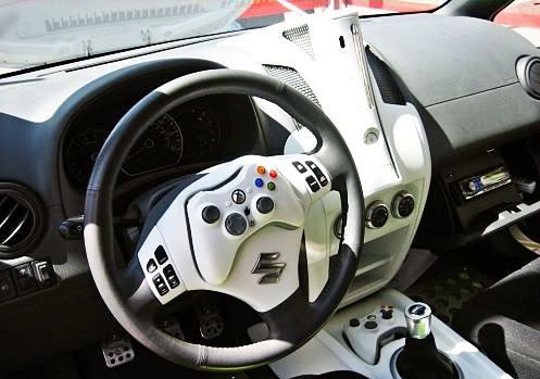
Slightly off thread, but see how someone has adapted their X-Box for car use, which means I suppose it won't be long before someone comes along and adapts it for use in an aircraft for those long and boring legs over the sea.
I doubt however that there are many X-Box aviation apps available yet!
I doubt however that there are many X-Box aviation apps available yet!
Joined: Nov 1998
Posts: 443
Likes: 40
From: A long way from home but seeing and experiencing the world!
The iwizwheel App is available on the iTunes store (at $AU29.95). Note that I bought it from the Aussie iTunes store, but imagine it would be avail in all, Note spelling is with one 'z' .Cheers and happy iPhoneing!!
Joined: Oct 2004
Posts: 32
Likes: 0
From: up north
Ability to see ones self on the screen using the video call camera. Eliminates the need for two winged master race to:
1 Get out of seat to use mirror facility to remined themselves how pretty they are (Multi)
2 Carry mirror in knee pad for same purpose (fastjet)
1 Get out of seat to use mirror facility to remined themselves how pretty they are (Multi)
2 Carry mirror in knee pad for same purpose (fastjet)
Joined: Jun 2006
Posts: 173
Likes: 0
From: Dorset
tried the artificial horizon app at 6k above dorset on Saturday. Vibration seemed to affect the internal sensors in the phone - a 60 degree turn was unregistered.. mates comment of "this may get us out of the !!!!! one day" was quickly retracted!!
The Wizwheel app seems really good though
The Wizwheel app seems really good though