


 6th Jan 2024, 07:24 - Wikipost
|
|||
|
|||

Which Aerodrome Mk IV

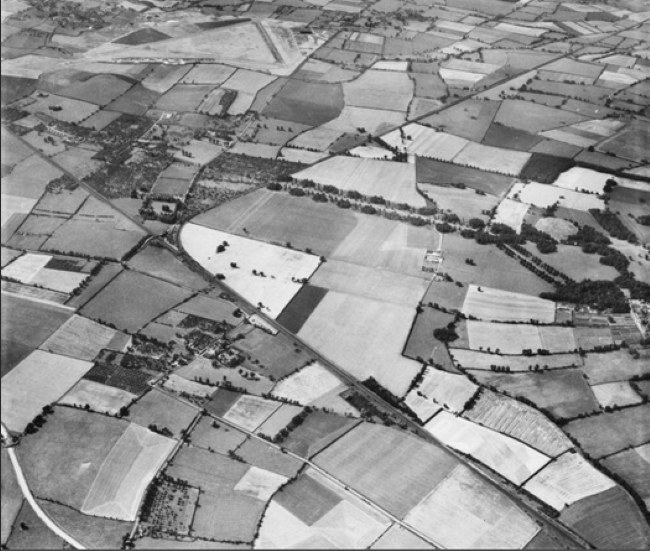
Sorry chaps the aerodrome is not in Suffolk. Just visible here in 1953 - I think flying ceased at the end of the war - the station was disbanded in 1948. Used thereafter for Government storage on a small scale. I'll put another clue up at bed-time if not guessed by then.

Sorry chaps neither Spilsby or Deopham Green - the latter I have happy memories of in high Summer fifty years ago when evidence of runways much reduced could still be seen.
Thorpe Abbotts - 100th Bomb Group base?
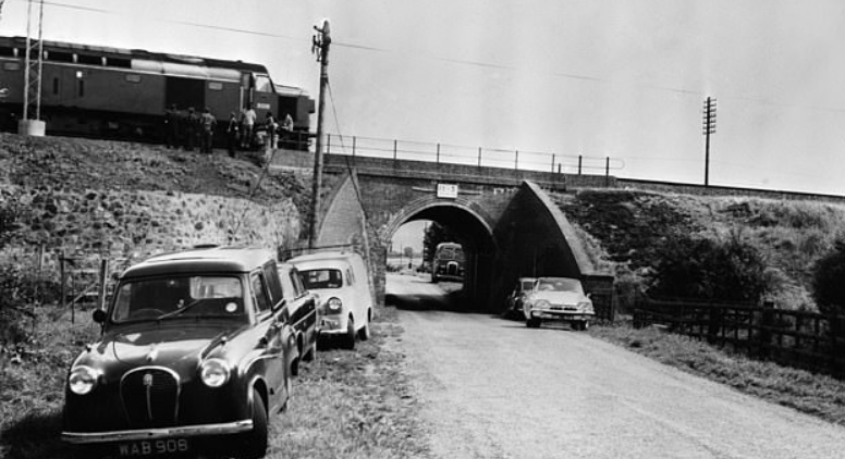
The Chief Constable of Buckinghamshire will be making a brief statement in due course.....Meanwhile keep digging !
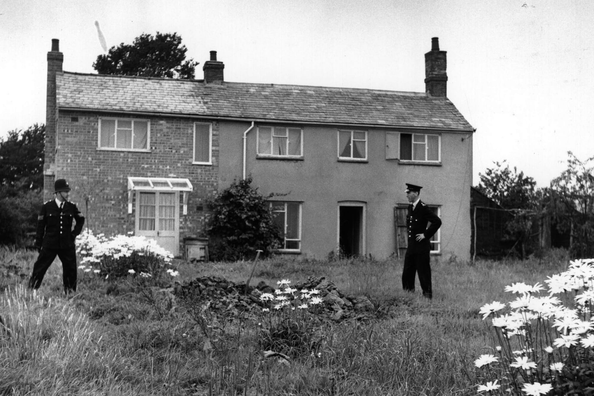
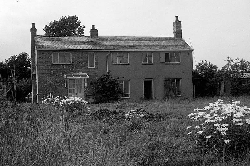
Leatherslade Farm near Oakley Bucks.
Leatherslade Farm near Oakley Bucks.
Last edited by OUAQUKGF Ops; 26th Jan 2023 at 13:22. Reason: Add caption
The LNER running from Euston starts at top left and branched off westerly from the main line to Aylesbury with Mentmore Park, one of the 4 Rothschild Mansions, just out of shot to the right (looking south west.) The Aylesbury Branch was the first railway line to reach Aylesbury from London and was the first to be 'lifted'.
Got my orientation wrong; I was thinking it was the main line which branched off to Skegness!!
Got my orientation wrong; I was thinking it was the main line which branched off to Skegness!!
Last edited by chevvron; 26th Jan 2023 at 10:46.
Yes I had hoped that you might cotton on Chevvron what with your Gliding history of the area......... A56 is usually pretty good on branch lines too. Chief Constable is forsaking lunch today for a brisk walk around the block. My officers have been quite busy........
Well done descol Cheddington Airfield it is. Satellite to USAAF Bovingdon - later known as RAF Marsworth.
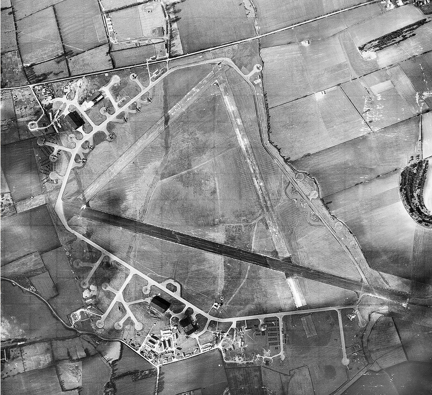
March 1944
https://www.tringruralhistory.co.uk/articles/good-old-da
Over to you descol....
March 1944
https://www.tringruralhistory.co.uk/articles/good-old-da
Over to you descol....
" A56 is usually pretty good on branch lines too. "
https://www.railmaponline.com/UKIEMap.php is a great resource!
https://www.railmaponline.com/UKIEMap.php is a great resource!
My mother was born in Pitstone, about half a mile east of Cheddington.
Post war there was a large amount of construction work along the previously barren eastern boundary. Myself and some mates went to explore in about 1968 ish in spite of the 'MOD Property' signs and were met with people in uniform demanding to know what we were doing there. Just east of the eastern boundary you can see the terraces of a small hill and local rumour was that it was CIA with some tunnels built into the hill hiding some sort of clandestine ammunition.
The old south east taxiway is now a private airstrip.
chevvron I don't know if you have read the link but there is mention of an underground bunker. Post-war I believe there was a small Ordnance Depot on the airfield an outpost of the huge Ordnance Depot near Bicester.