


FIDO

Thread Starter
Join Date: Dec 2011
Location: herts
Posts: 1,838
Likes: 0
Received 0 Likes
on
0 Posts
FIDO
Can't find a thread for FIDO, so thought I'd start one.
Any ideas on the airfields shown in the film? I think the one at 8:43 might be Bradwell Bay. But the one at 8:50 doesn't seem to match up with any of the ones on the list at 09:30
Any ideas on the airfields shown in the film? I think the one at 8:43 might be Bradwell Bay. But the one at 8:50 doesn't seem to match up with any of the ones on the list at 09:30


Some of the FIDO tracks are still evident at Blackbushe (original name used in the film)
If you look at www.blackbusheairport.proboards.com somewhere on trhe site are photos and film of an aircraft using the FIDO there taken sometime in the '50s..
If you look at www.blackbusheairport.proboards.com somewhere on trhe site are photos and film of an aircraft using the FIDO there taken sometime in the '50s..
Thread Starter
Join Date: Dec 2011
Location: herts
Posts: 1,838
Likes: 0
Received 0 Likes
on
0 Posts
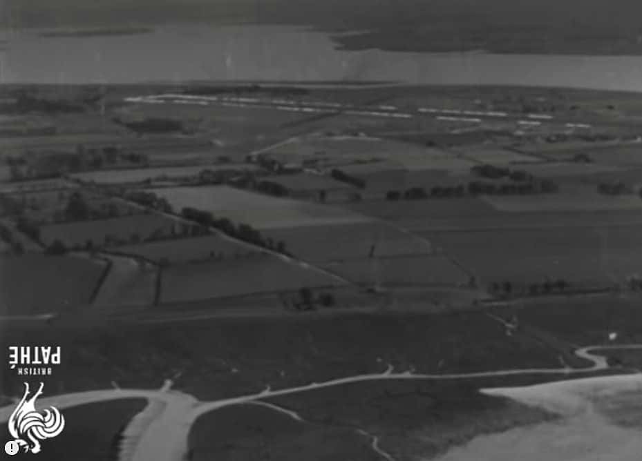
eckhard - Definitely agree with the first few shots of runway in that it is Bradwell Bay, but the runway at 08:50 looks to be right by the water with what looks like another coast behind it with a river running through it.

Or am I looking at it completely the wrong way?
Or am I looking at it completely the wrong way?
Or am I looking at it completely the wrong way?
Looks like the Blackwater estuary with Osea Island in the background so looking just north of west.
Last edited by chevvron; 13th Jun 2020 at 07:42. Reason: Fix quote
Thread Starter
Join Date: Dec 2011
Location: herts
Posts: 1,838
Likes: 0
Received 0 Likes
on
0 Posts
Ahhhhh.......... got it now, didn't think of it being upside down, even though the map in the next bit of film is as well - I'll remember this technique for the Which Aerodrome thread 
So that is Gunners Creek in the foreground, with St Peters Chapel on the shore.
So that is Gunners Creek in the foreground, with St Peters Chapel on the shore.
IIRC there was a Fido installation at Marham up to the early sixties. Another was at Woodbridge in Suffolk. Woodbridge was one of three emergency airfields built for returning aircraft in distress with extra long runways, Manston and Carnaby being the others.
From Wiki about Woodbridge:
From Wiki about Woodbridge:
About 30% of the emergency landings were caused by bad weather, especially fog which could be dispersed by Fog Investigation and Dispersal Operation (FIDO) where up to 450,000 litres (99,000 imp gal; 120,000 US gal) of petrol per hour was pumped through a system of pipes along the side of the runway and burnt to produce a wall of flames which would lift the fog. Fuel was transported to Melton railway station before being piped to the airfield.[2]
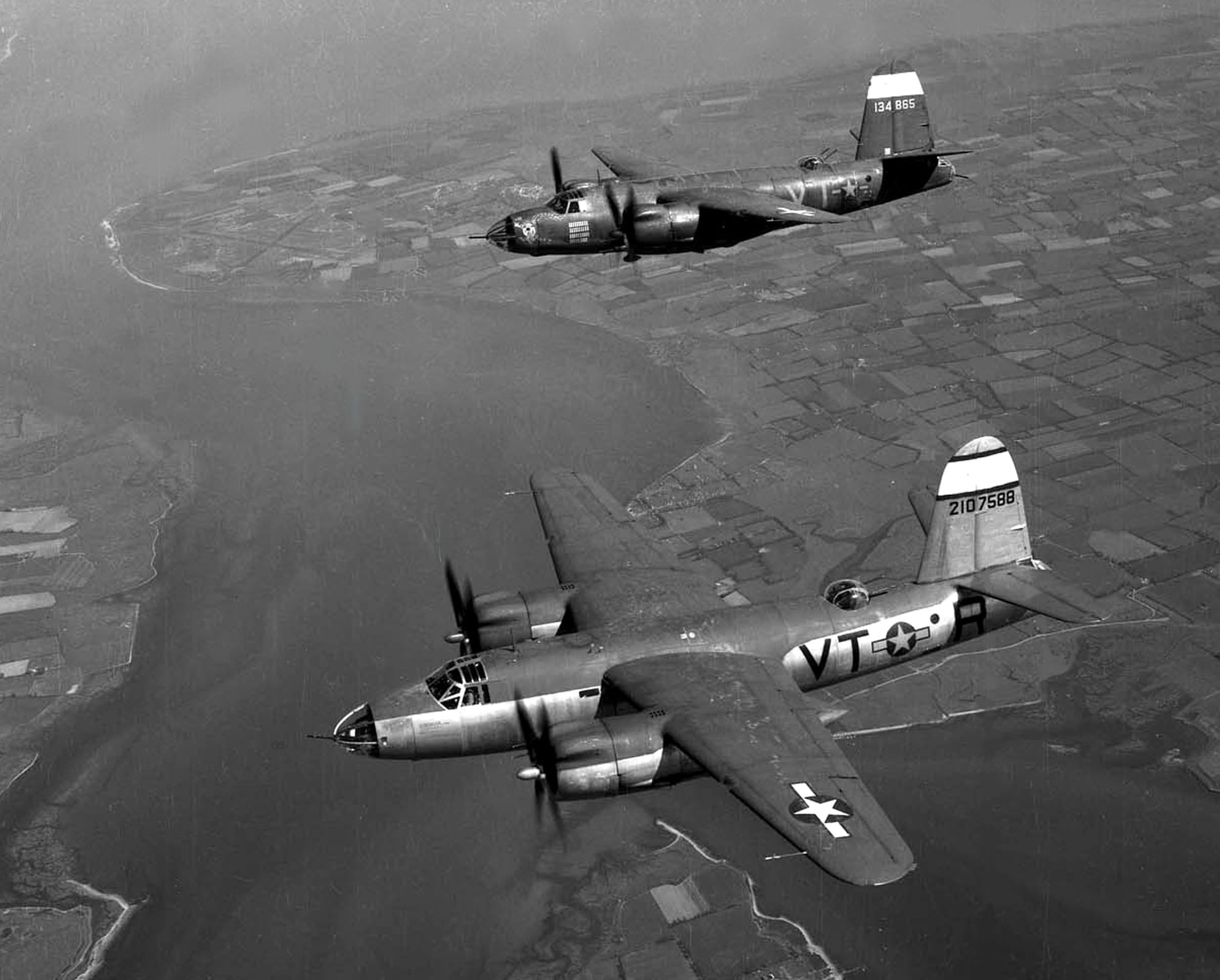
Another view of Bradwell Bay (upper left) in this shot of US Ninth Air Force 323rd BG Marauders heading north. Pre-FIDO, I'm guessing.
While working at Bentwaters in around 1999 I visited Woodbridge, then used by the Army for Apache training, and saw the FIDO installation which had never been removed, and is probably still there now.
Very large diameter pipes (10 - 20 inches? I can't remember) ran along each side of the whole length of the much wider runway than normal for WWII bomber operations. These fed the burners that created the flarepath. I didn't see any of the pumping equipment; maybe it had gone.
It was clear that the system would have used thousands of gallons of gasoline for each minute of operation. At least i think it was gasoline.
My father, a Lancaster pilot, said that others told him that landing while the FIDO was burning was more terrifying than stooging about over Berlin waiting to bomb, and I can easily imagine that it would be, especially with a damaged aircraft.
On the other hand, it worked; the flames would act as a guide, and the heat dispersed the fog just enough to enable the pilot to see where the runway was and touch down, with enormous care to maintain direction on the centreline.
My Dad did a FIDO landing in an Oxford at Fiskerton, he described it as "like flying into the fires of hell".
Psychophysiological entity
For a while I commuted between Luton and Frinton on Sea in a Rallye Club. The crewing bod said I'd have to take my fair share of night flights so I braved the first flight home after friends said they'd make me a flare path. All was okay until I got to SW Stansted where I started to get kind of confused by what I could see. Still a long way to go and while Chelmsford, Braintree, Colchester etc., all looked okay, Clacton, Holland on Sea and my home town looked totally wrong. At one point I almost turned around. I was so used to that area, lived there, trained there, but this now just looked wrong.
When I got to my field my palls had made around 20 cans with paraffin and a rag. The light to my night vision was disabling. I was holding my arm up to shield my eyes as I landed.
When I got to my field my palls had made around 20 cans with paraffin and a rag. The light to my night vision was disabling. I was holding my arm up to shield my eyes as I landed.