


 2nd Mar 2020, 14:35 - Wikipost
|
|||
|
|||

Which Aerodrome Mk III

Join Date: Dec 2011
Location: herts
Posts: 1,838
Likes: 0
Received 0 Likes
on
0 Posts
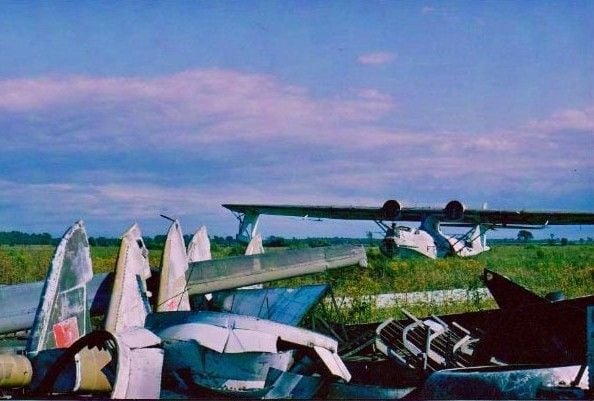
I thought the underground hangars were rather a large clue - however, when I searched for Marghana on GE, it sent me to India 
But you are correct it is Marghana on the island of Pantelleria

The hangars are still there.
But you are correct it is Marghana on the island of Pantelleria
The hangars are still there.

Is this one too easy?

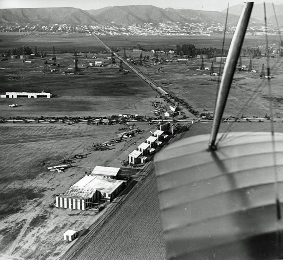
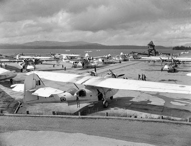
This is Chaplin/Rogers Airfield* at the intersection of Fairfax Avenue and Wilshire Boulevard. The houses in the distance to the north, are in what is known today as Hollywood Hills West.
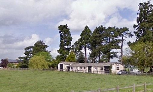
The area looks a lot different today:

* The airfield was established by Sydney Chaplin, Charlie's older brother. It was later bought by Emory Rogers and renamed.
Aviation History of the Miracle Mile
I cannot find the name of the oilfield but immediately to the east (right) of the picture are the famous La Brea Tar Pits and the Page Museum.
Last edited by India Four Two; 20th Nov 2020 at 04:56. Reason: Spelling and grammar.
Indeed Rogers Field or in 1922 when the photo of air fair was taken: Chaplin field.
Next it was Mille field.
The oilfield must have been the Los Angeles City Oilfield.
There is 1 well left which is still producing 3,5 barrels a day.
Take it away India!
Next it was Mille field.
The oilfield must have been the Los Angeles City Oilfield.
There is 1 well left which is still producing 3,5 barrels a day.
Take it away India!

Are you sure?
On the Internet I found several sites mentioning underground repair shops and also that an attempt was made to start cutting out hangars in the west ridge of Ta Qali.
But these attempts proved the rock was too soft. As the attempts were also discovered by the Germans, they did a heavy bombing.
After the Bombing, hangars doors were painted on the ridge in an attempt to lure further attacks to this further unused area of the air base.
I would be surprised if that would be a well, but it is the only likely spot in that street.
It shows that there are more active wells which are part of this Oil field. It seems that the name differs per well
More wells in LA
It shows that there are more active wells which are part of this Oil field. It seems that the name differs per well
More wells in LA
The oilfields of the Los Angeles basin have a really interesting history. Anyone with some time to spare when leaving LAX in a rental car should drive through the Baldwin Hills oilfield between LAX and Downtown. This oilfield was used as a backdrop for the motel scenes in L.A. Confidential.
No oilfields here:
No oilfields here:
That truck looks very N american - are we in Canada perchance?
are we in Canada perchance?
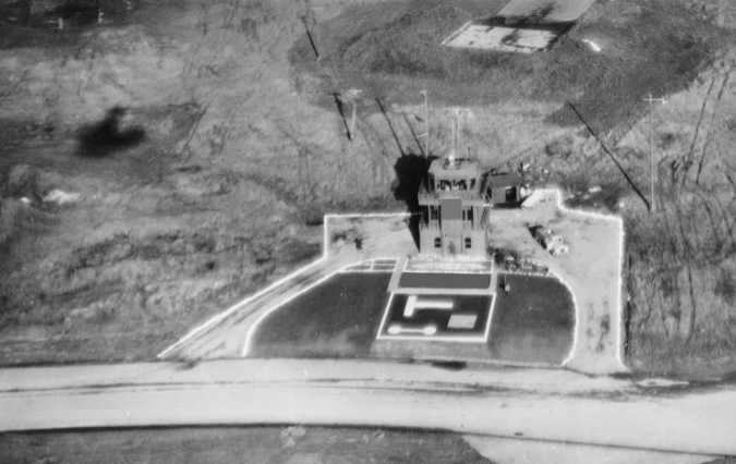
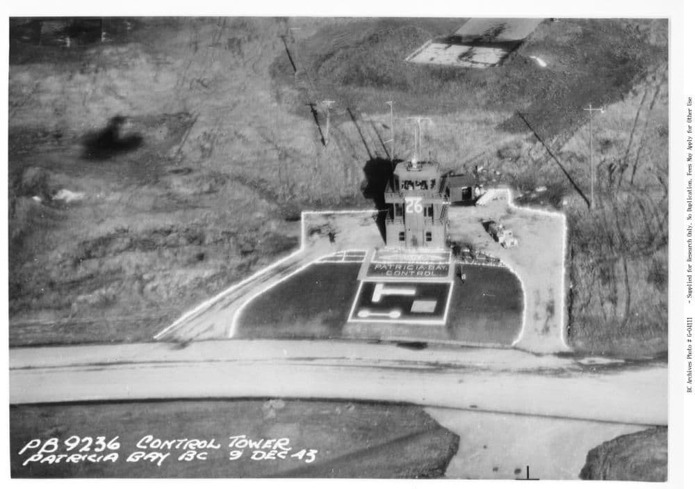
A possible clue - after I had posted this photo, I noticed the shadow, which combined with the location of the signal square, indicates that the tower is on the north side of the field. This surprised me as the current tower is on the southern side. A search on GE indicates vague traces of the former tower's location.
Yes, it is what used to be known as RCAF Patricia Bay and is now Victoria Airport (CYYJ).
I think you must be right about the runway number. They were using the other direction when my picture was taken. I had assumed that 26 was the elevation, but it is actually 64'.
I was planning these further pictures, if required:

Slb has control.
I think you must be right about the runway number. They were using the other direction when my picture was taken. I had assumed that 26 was the elevation, but it is actually 64'.
I was planning these further pictures, if required:
Slb has control.
doesn't look like Essex... Europe?