


Mooney M20K crashed near Springbank Airport, Calgary

Thread Starter
Mooney M20K crashed near Springbank Airport, Calgary
The Mooney came down in a field near Springbank airport, west of Calgary. Two POB, one fatality and one serious injury.
Right wing completely missing.
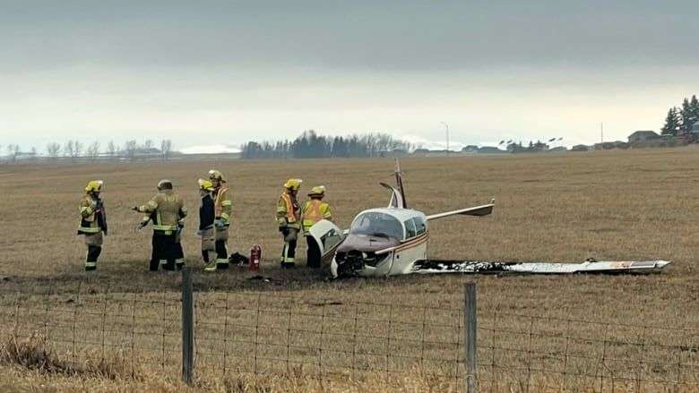
Based on the background in this telephoto image, the location appears to be about half a mile south of the threshold of 35, which is off to the right of the picture.
https://www.cbc.ca/news/canada/calga...gary-1.6428441
https://www.aviation-safety.net/wikibase/277600
Right wing completely missing.
Based on the background in this telephoto image, the location appears to be about half a mile south of the threshold of 35, which is off to the right of the picture.
https://www.cbc.ca/news/canada/calga...gary-1.6428441
https://www.aviation-safety.net/wikibase/277600
Last edited by India Four Two; 23rd Apr 2022 at 01:19.

Moderator
That was a hard hit, and the plane is not pointed in its direction of travel. I would wonder if the wing hit something at ground contact, but there's not much to hit there... Roadside pole?
Thread Starter
PD,
More photos have been published. It went through the fence on the north side of Highway 1, which is a busy four-lane divided highway.
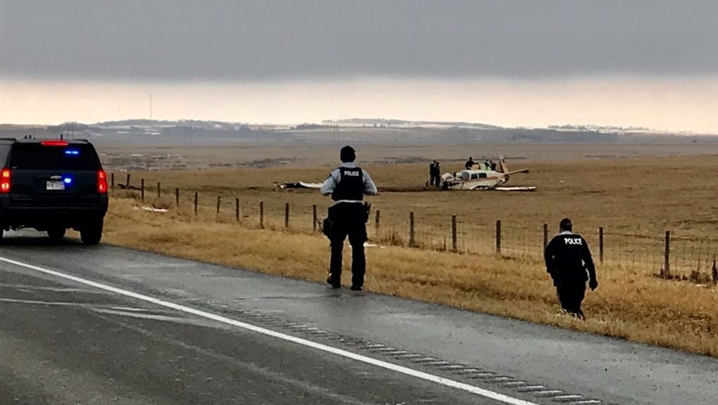
The right wing is behind the Mountie walking on the road.
Note you can see the ATC tower to the right of the fence post, in the photo above.
The Mooney was clearly very low as it crossed the highway. No mention of it hitting any vehicles, which was very lucky. There are no tall poles in this area. It looks like the damage was caused by the wing hitting the edge of the ditch on the side of the highway.
A TV report says this happened after takeoff. I don't know which of the four runways was in use, but I'm speculating that this was a turn back.
More photos have been published. It went through the fence on the north side of Highway 1, which is a busy four-lane divided highway.
The right wing is behind the Mountie walking on the road.
Note you can see the ATC tower to the right of the fence post, in the photo above.
The Mooney was clearly very low as it crossed the highway. No mention of it hitting any vehicles, which was very lucky. There are no tall poles in this area. It looks like the damage was caused by the wing hitting the edge of the ditch on the side of the highway.
A TV report says this happened after takeoff. I don't know which of the four runways was in use, but I'm speculating that this was a turn back.
Last edited by India Four Two; 23rd Apr 2022 at 03:11.
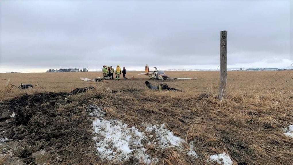
Unusual to see the prop so far away from the plane . Bend indicates the possibility of the prop contacting something first .Gear ripped off or not lowered ? looks like a wheel not far from prop , caught on the fence ?
Thread Starter
On close examination, it looks like there is a fork by the wheel, which would make it the nose wheel.
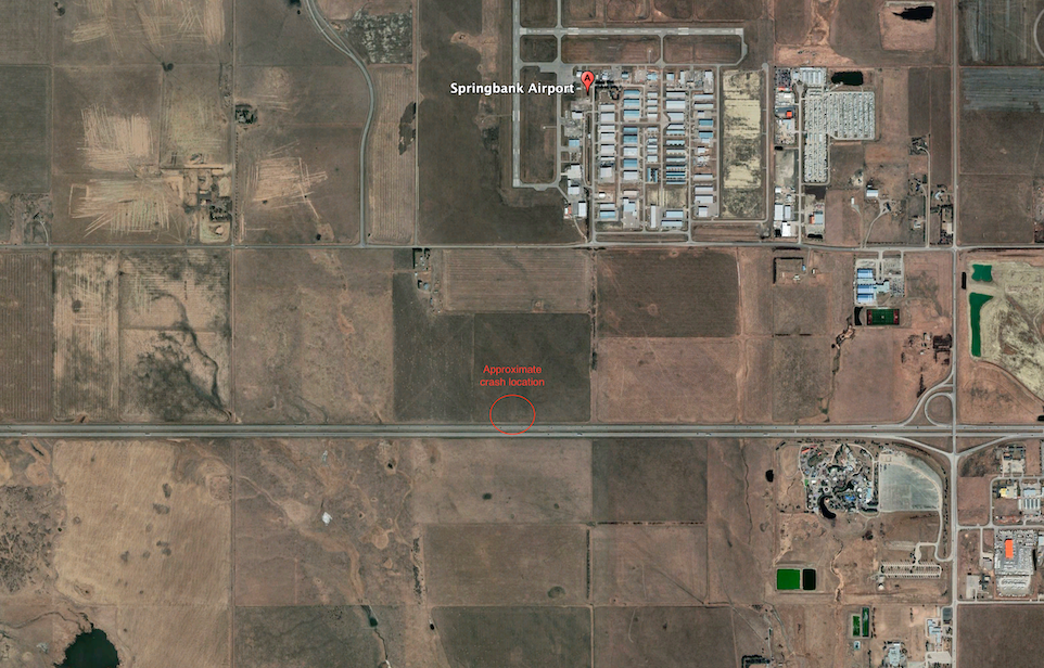
Sad when there's highly survivable fields south of Hwy 1 had they chosen to land straight ahead.
Thread Starter
I had the same thoughts. For the benefit of those who don’t know the area, all of those brown fields in the GE image, are “walk away from the crash” territory and most of them are probably “get to use the aircraft again” territory.
Thread Starter
It turns out the Mooney was returning from a local flight and was on a straight-in approach to 35. More details including a link to the track here: https://www.aviation-safety.net/wikibase/277600
The pilot who died was being checked out by an instructor, who was seriously injured.
I have been told unverified rumours by local pilots that this particular Mooney had a history of engine-maintenance issues.
The pilot who died was being checked out by an instructor, who was seriously injured.
I have been told unverified rumours by local pilots that this particular Mooney had a history of engine-maintenance issues.
Thread Starter
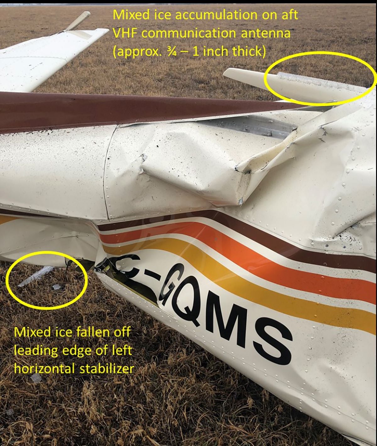
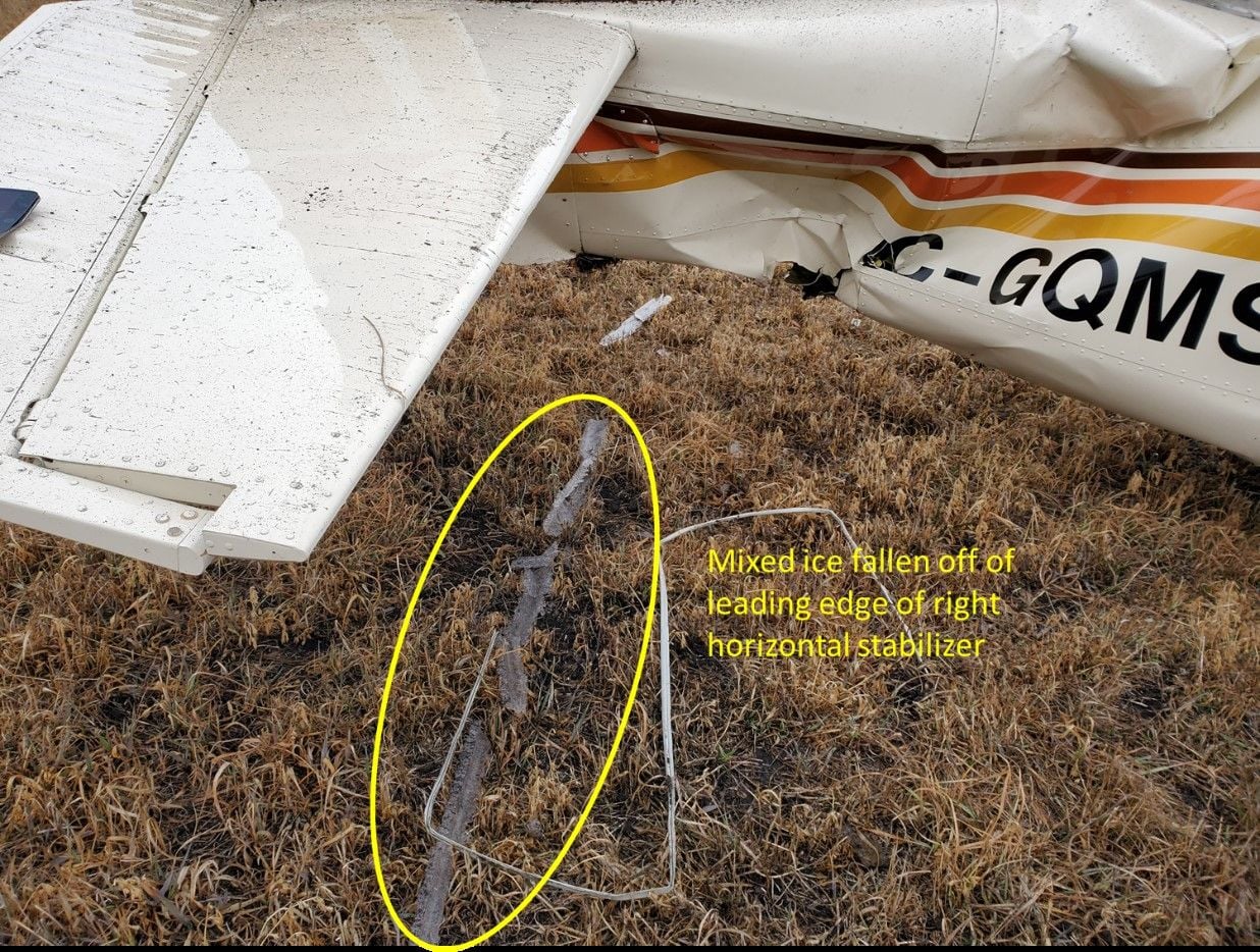
Final report. The crash was due to icing.
https://www.bst-tsb.gc.ca/eng/rappor.../a22w0027.html
Photos taken by RCMP officers shortly after the crash:
https://www.bst-tsb.gc.ca/eng/rappor.../a22w0027.html
Photos taken by RCMP officers shortly after the crash:
Kudos to RCMP for taking these photos before the ice melted
