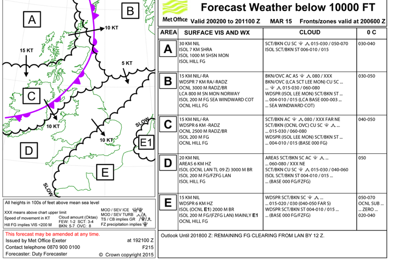
On the 19th March, myself and two good friends set off on a bit of an adventure (perhaps an understatement!) to view the Eclipse from the air. Our plan was to head up to Stornaway (PPR booked in January incase it got a bit busy!), have a good nights kip then depart early morning and head out to the RATSU triangle (61N 10W) and view the Eclipse from there.
As people will be aware, the best place to view it this year was in the North - some people opting to head to the Faroe islands would have been in for a disappointment due to cloud cover on the actual day. We thought we would play it safe and, other than some high level cloud, we should have been in for a great session.
The aircraft of choice for this mission was the trusty PA34-220T Piper Seneca III.
Although I had an MEP and had flown many different types (DA42, DA42 NG, Cougar, Duchess etc) - I had never flown anything with a conventional turbo in it! So a few days before the trip, I completed my turbo differences training and went up with Ray (the owner) for a briefing on the aircraft.
The beast is on it's original engines now and, though they are on condition - they perform very very well if you treat them nicely :-)
My check flight completed and our plans drawn to conclusion, we set off to Stornoway.
Ray's son was involved in this trip - he is a HUGE astronomer and was dead excited to be as involved as possible on this trip too!
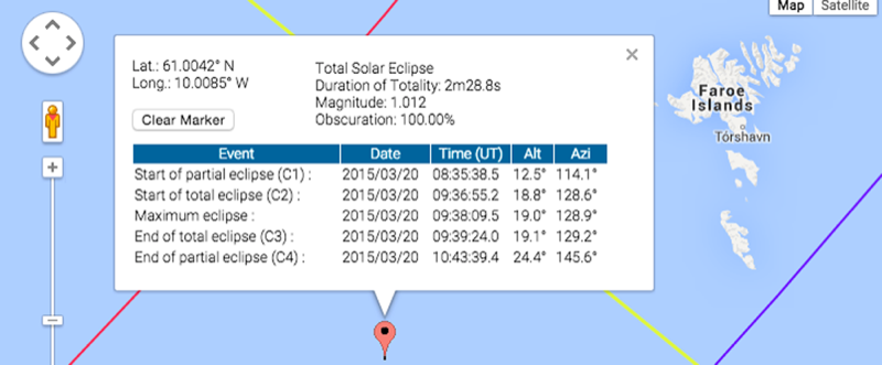
Using some Nasa web pages, we knew in advance the timings of first contact, start of totality and end plus the angle of the sun in the sky and the bearing for the sun.
Our plan was to head as close to 61N 10W without busting Shanwick OCA and, being in class G, we could do pretty much as we wanted.
Knowing the sun was due to be at 129�, we opted to intercept flying 040� to maximise totality and get the best view perpendicular to the track. It also meant that the shadow which travelling at 600mph would "chase" us as we headed north east :-)
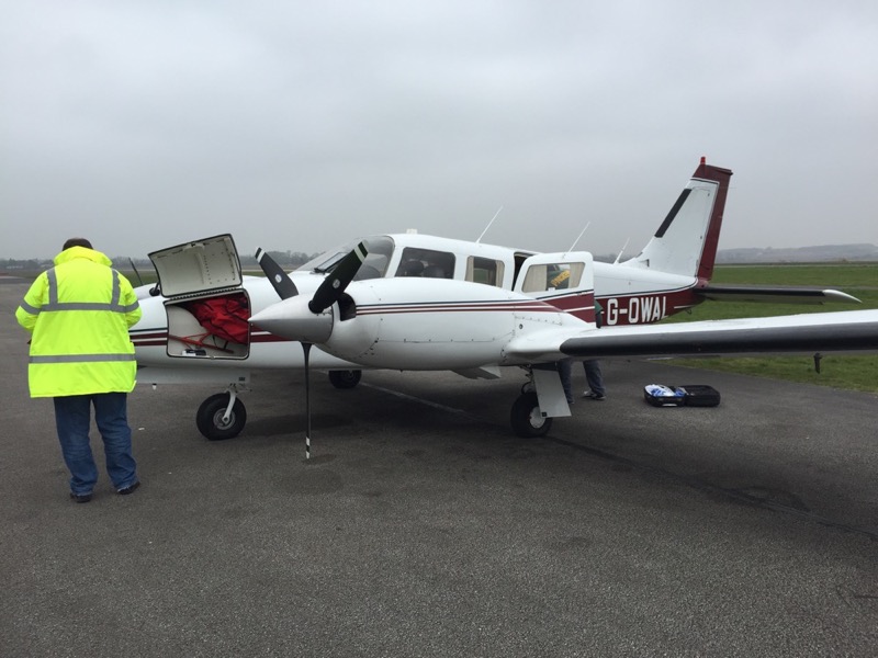
Our trusty aircraft! Not forgetting the hi-viz of course!!! :thumleft:
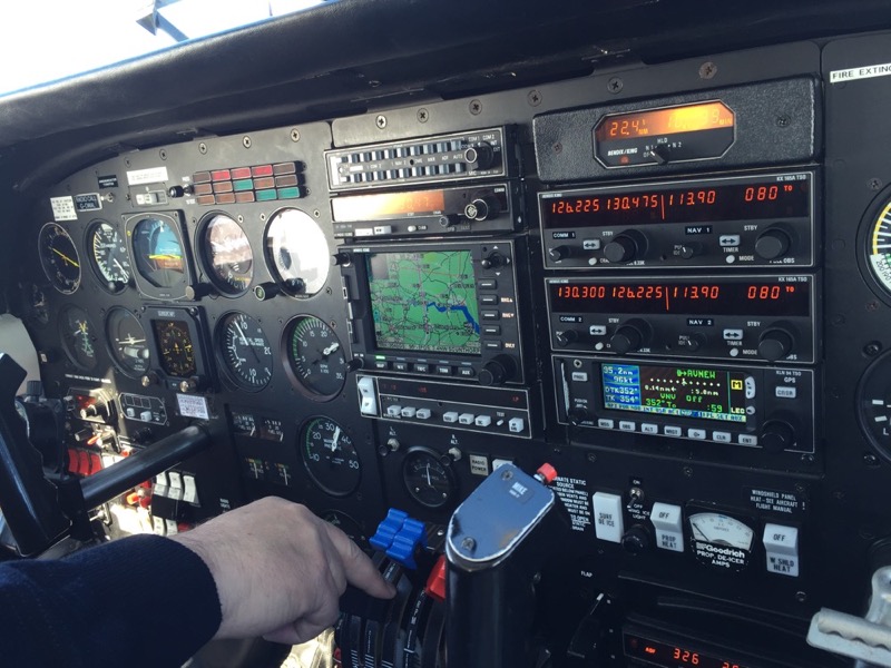
On the climb out from Gamston. The aircraft is fitted out with TCAS and weather radar plus EPGWS, flight into known icing conditions etc plus as it was on public transport, is fitted out with a full suite of instruments from the P2 side where I was on the way up.
Our route on the way up was very easy - out to Gainsborough and overhead Durham, Newcastle, Dundee, turn at Inverness under the airways and track to the Stornaway VOR. This would all be conducted under the privileges of an IR(R).
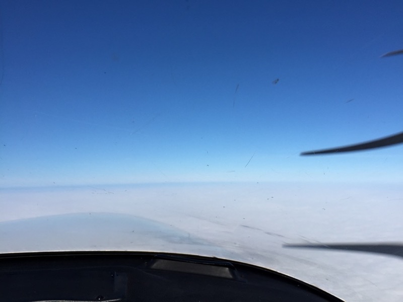
VMC on top at 10,000ft and a nice wind pushing us along at 173kts GS!
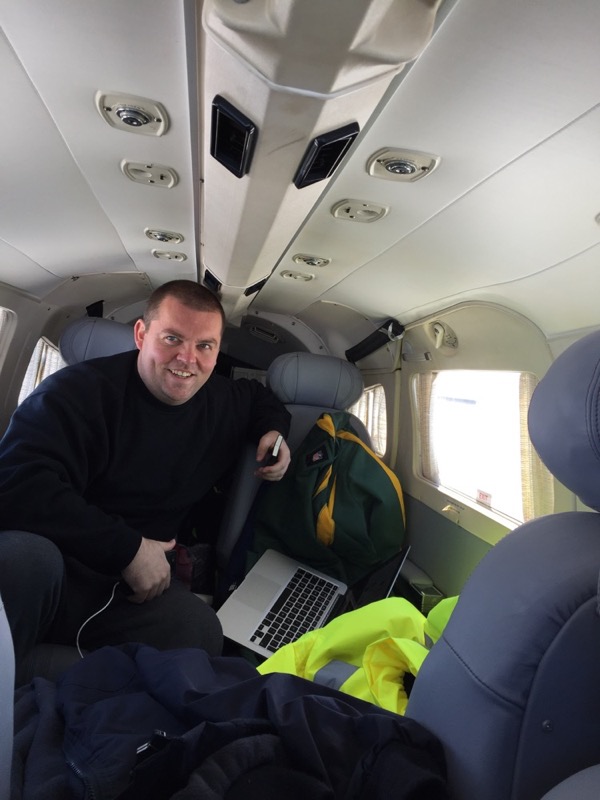
Plenty of room in the back of the Seneca - needed for all of our gear!

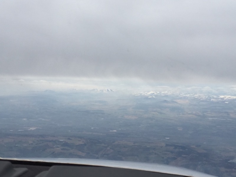
Approaching Dundee from the south - we could see it was starting to get a little mirky ahead.
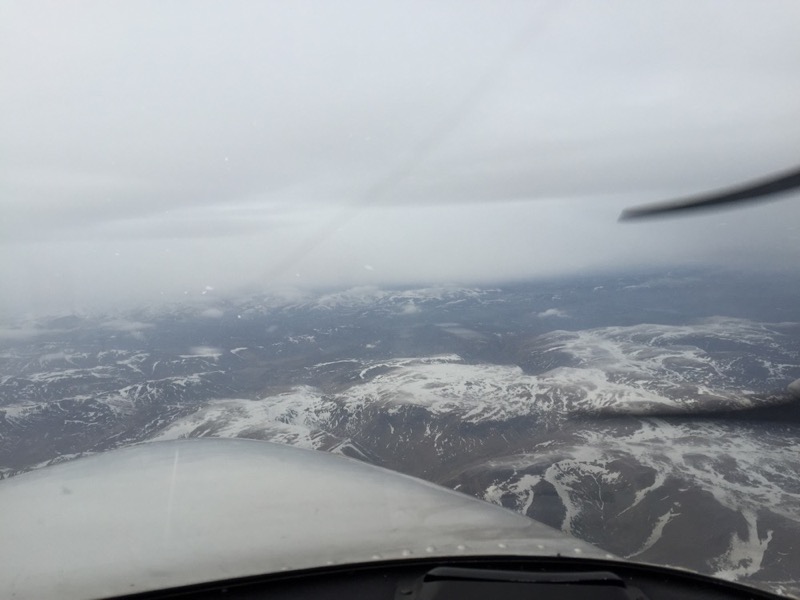
Snow was still present as we approached the highlands. The prop de-ice was on at this point as the OAT was showing nearly -20�c - and the heater wasn't performing very well either!!
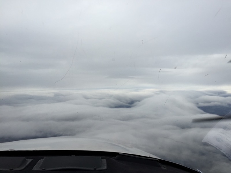
Having turned at Inverness and approaching the higher ground, the wind was now on our port side and, as we could see on both the weather radar and out the window, it was going to get choppy. We descended once over the sea to 3000ft (at 1500fpm) due to massive updrafts and downdrafts - this but was NOT pleasant!
On approaching Stornaway, we received the ATIS and noted clouds few 600ft broken at 1200ft. The controller on initial contacted cleared us to join left downwind runway 18 (we assumed the weather was improving for this!) - however, down at 600ft and STILL in IMC we called to confirm the weather where he then told us to position overhead STN for for the procedure.
Both of us up front being rated (Ray is a 1300 hours IR) both assumed they would want us to perform the BEST procedure available (i.e. NDB DME LOC RWY18). There was a Saab outbound from the SAY NDB (west of our position).
We were asked to climb to 3000ft and report on the 329 radial. So we positioned to intercept, a little confused as to why that was requested. We were then asked to report out position (we were overhead the STN). The controller asked us to make an immediate 180 due to traffic in the overhead. Again - we headed out to see on the 150 radial and asked to position once again for the 329. This got us both into a bit of a flap. We then heard the Saab pilot giving the controller some grief about confliction and that his intentions were not clear. He then stated he was expecting us on the INITIAL APPROACH for RWY18 (we assumed with the information given he wanted to fly the circle til visual approach - lesson here - ASK FOR THE PROCEDURE!). We requested to head to the NDB to fly the procedure which we were approved to do. This all went smoothly and we became visual at 680ft 1 mile out on RWY18.
On the ground we refuelled, we were apologised to and got a taxi to our hotel.
Fuel was �1.96 per litre for info and landing fees plus nav charges (and overnight parking) were �48.81.
The next morning at 05:55, we were up and inputting the wind data into our custom made spreadsheet. This would give us the time to the waypoint, track/drift and allowed us to see exactly what time we had to depart to ensure we could hit the waypoint BEFORE totality.
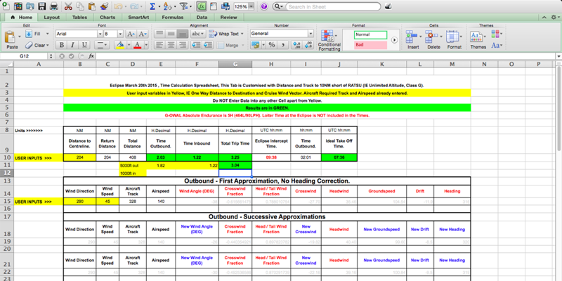
The wind was forecast to be 290/45 at 10,000ft which as you can see gave us a 2 hour outbound leg and then 1.2 hour return leg. The ideal take off time was 07:36.
Myself and Ray decided (using the data from here) to head out a little lower than 10,000 (7000ft) to have less of a headwind component.
We also opted to depart at 07:10 and throttle back (watching the ETA on the GPS incase the winds were stronger than planned). We have 5 hr Endurance