The images do NOT show tracks.
The images do NOT show tracks.
The images do NOT show tracks.
The primary purpose of this post is to indicate using symmetry the location of the southern position line. It is a LONG way from anywhere.
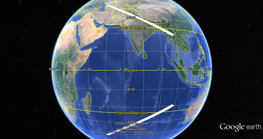
The diagram shows a representation of an estimate of the two position lines (with uncertainty) described in the press conference as being the position lines indicated by the last received "ping".
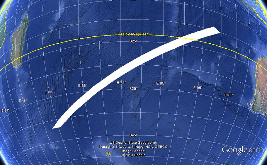
Since the satellites are geostationary, that is above the equator, I have assumed that the two lines are symmetrically disposed about the equator.
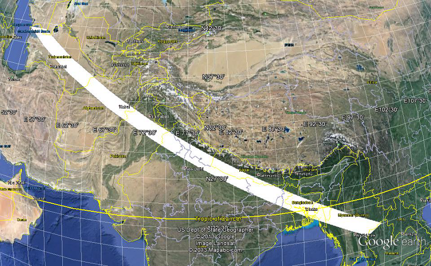
The two lines are based on the PMs statement; "a northern corridor stretching approximately from the border of Kazakhstan and Turkmenistan to northern Thailand", a *
random* line between the two points (generated by Google Earth), and a southern copy of that line reflected in the equator.
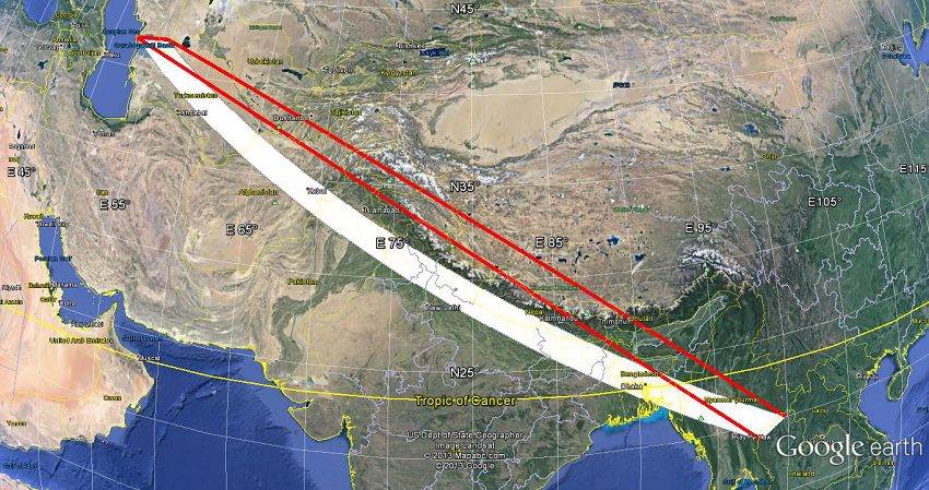
The last image shows an additional alternate random position line between the two points. The white rectangle was drawn with the Google Earth "add polygon" tool with four points and the orange line with the "add path" tool with four points.
Please note:-
The images do NOT show tracks :-)))))
Hopefully a mathemetician will be along in a minute to explain the correct shape of the lines.
Two estimated position lines for the LAST "ping".
Northern
Southern
Alternate northern - showing an alternative estimated line.
Higher resolution versions are available at (hopefully):-
http://i783.photobucket.com/albums/y...copter/malasia