Originally Posted by
Kiwiconehead
When I first had the news pop up on my phone I pictured that video from 2002 - but now I'm picturing that RJ-85 video from last year.
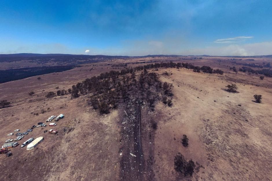
It's hard to tell from that picture how much of a slope up there is at the site - some pictures make it look quite steep. How does the terrain height at the impact site compare to where they dropped?
If you can determine the crash location, you might be able to find the topographic map here:
https://maps.six.nsw.gov.au/etopo.html