The whole runway is just 0.76 NM, and there is no displaced threshold for landing 08, so the whole runway is available. And if you extend the runway to the left by the same amount again (yellow bar, still less than 0.8 NM), you end up at the turn to crosswind for
departing aircraft, the dashed line with the arrowhead at the bottom, which goes in southerly direction on the western side of the motorway.
If you mark the final (orange bar) for the
arriving traffic, going on the eastern side of the motorway, and copy that mark to the scale at the bottom of the chart, you see that it is only 0.4 NM.
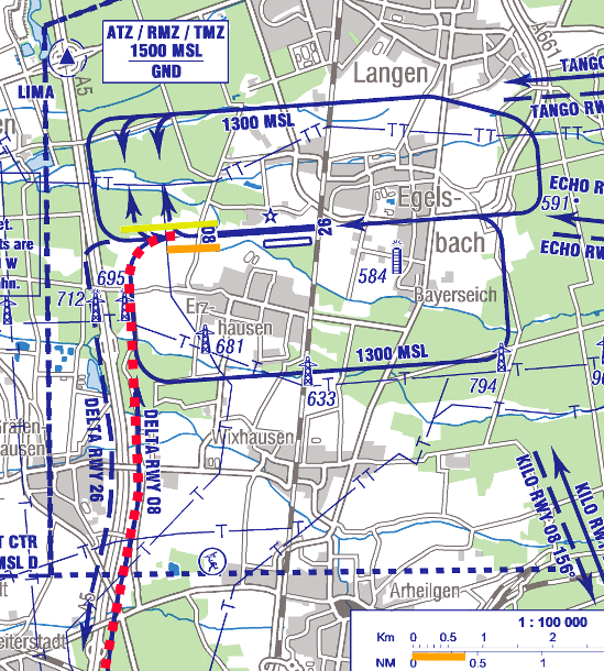
Yes, I know that the Epic didn't fly the red dotted path, and I didn't write that it had. How would I plot a path that nobody knows? I clearly wrote that the red dotted path is the
only permitted approach to 08 for turbine aircraft. It is the path it
should have flown:
Bernd