


RAF Pilots' low level map

Thread Starter
Join Date: Dec 2007
Location: england
Posts: 613
Likes: 0
Received 0 Likes
on
0 Posts
RAF Pilots' low level map
Guys, a while back I saw a simplified map of the UK with important waypoints like "sally's wotsits" etc. Can anyone point me in the right direction?

Join Date: Jul 2006
Location: Driving Buses
Posts: 44
Likes: 0
Received 0 Likes
on
0 Posts

Join Date: Oct 2004
Location: Up there somewhere
Posts: 431
Likes: 0
Received 0 Likes
on
0 Posts
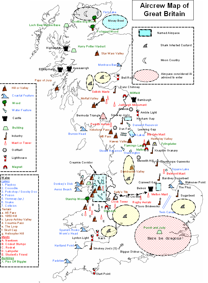

Where are sally's tits geographically? And couldn't find the "piss off Biggles" building!
Piss off Biggles is denoted by the green cross in North Wales. It may have been removed in the last 6 months though.
TF
The magnet is cunningly placed to draw in the unwary (ie everybody) in the area into Shobdon.
Piss Off Biggles is here:
Target Aviation Photography
and here:
Google Maps
Piss Off Biggles is here:
Target Aviation Photography
and here:
Google Maps

Time Flies; that's the Malvern Hills, Sally's Tit's are Clee Hill (obvious by the Nats en route radar on top).
Cheers,
TF
Yeah, but what do the magnet symbols really really signify

